MyTopo
Pahrump Nevada US Topo Map
Couldn't load pickup availability
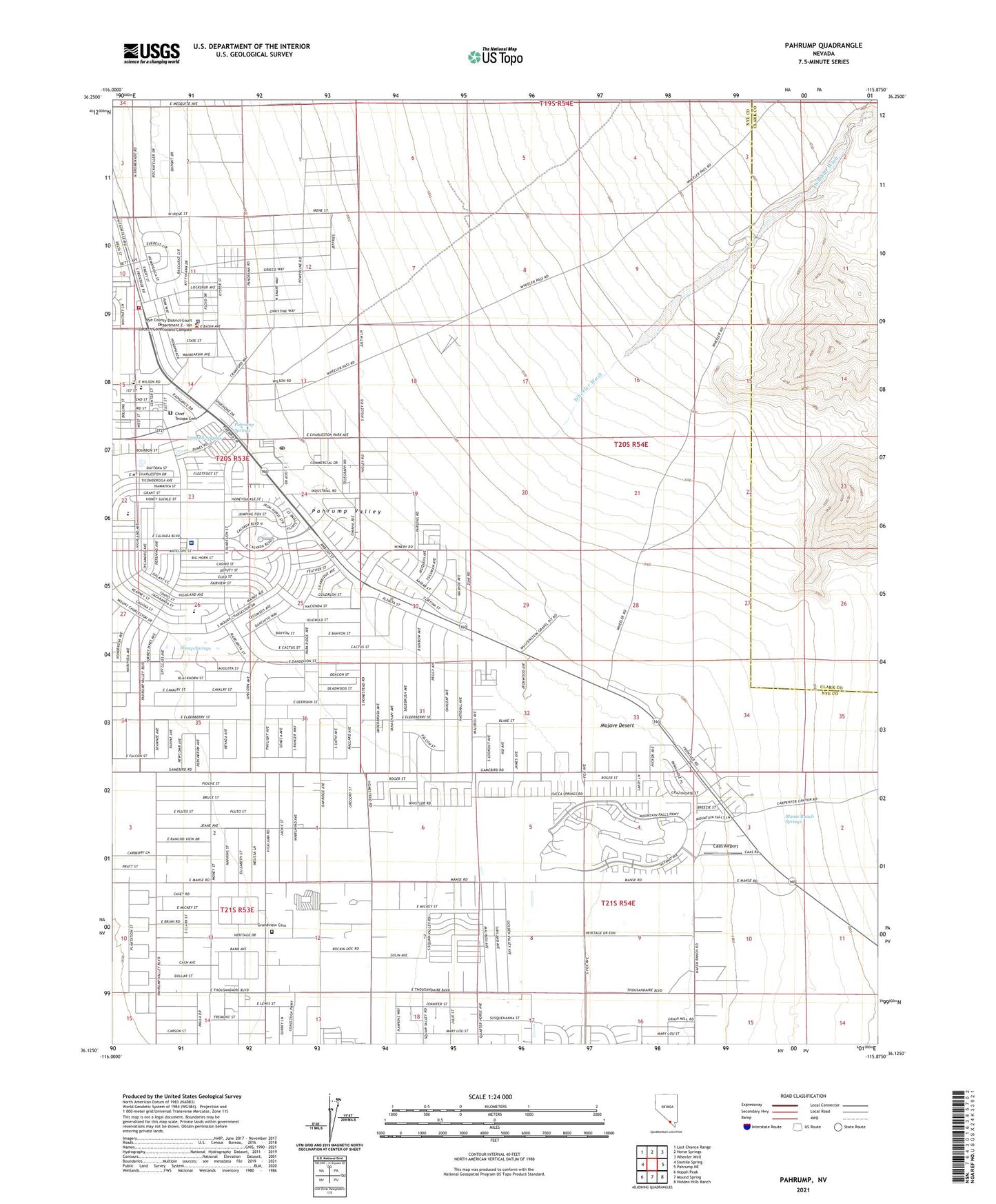
2023 topographic map quadrangle Pahrump in the state of Nevada. Scale: 1:24000. Based on the newly updated USGS 7.5' US Topo map series, this map is in the following counties: Nye, Clark. The map contains contour data, water features, and other items you are used to seeing on USGS maps, but also has updated roads and other features. This is the next generation of topographic maps. Printed on high-quality waterproof paper with UV fade-resistant inks.
Quads adjacent to this one:
West: Sixmile Spring
Northwest: Last Chance Range
North: Horse Springs
Northeast: Wheeler Well
East: Pahrump NE
Southeast: Hidden Hills Ranch
South: Mound Spring
Southwest: Nopah Peak
This map covers the same area as the classic USGS quad with code o36115b8.
Contains the following named places: Bennetts Ranch, Bob Budd Speedway, Caas Airport, Chief Tecopa Cemetery, George P Brooks Well, Hafen Ranch, Ivanpah Springs, J G Johnson Elementary School, Mankins Ranch, Manse, Manse Post Office, Manse Ranch, Manse Ranch Springs, McGowan Ranch, Mount Charleston Elementary School, Nevada Highway Patrol Southern Command Pahrump Substation, New Hope Christian Academy, Nye County Complex, Nye County Sheriff's Office Headquarters, Pahrump, Pahrump Census Designated Place, Pahrump Government Complex, Pahrump Intermediate School, Pahrump Junior High School, Pahrump Landing Strip, Pahrump Memorial Arena, Pahrump Post Office, Pahrump Primary School, Pahrump Ranch, Pahrump Springs, Pahrump Valley Christian School, Pahrump Valley Fire and Rescue Station 1, Pahrump Valley High School, Pathways High School, Pathways Middle School, Ray Thomas Well, Raycraft Well, Stump Springs, United States Department of Veterans Affairs - Southern Nevada Healthcare System Pahrump Clinic, Wheeler Wash