MyTopo
Sixmile Spring Nevada US Topo Map
Couldn't load pickup availability
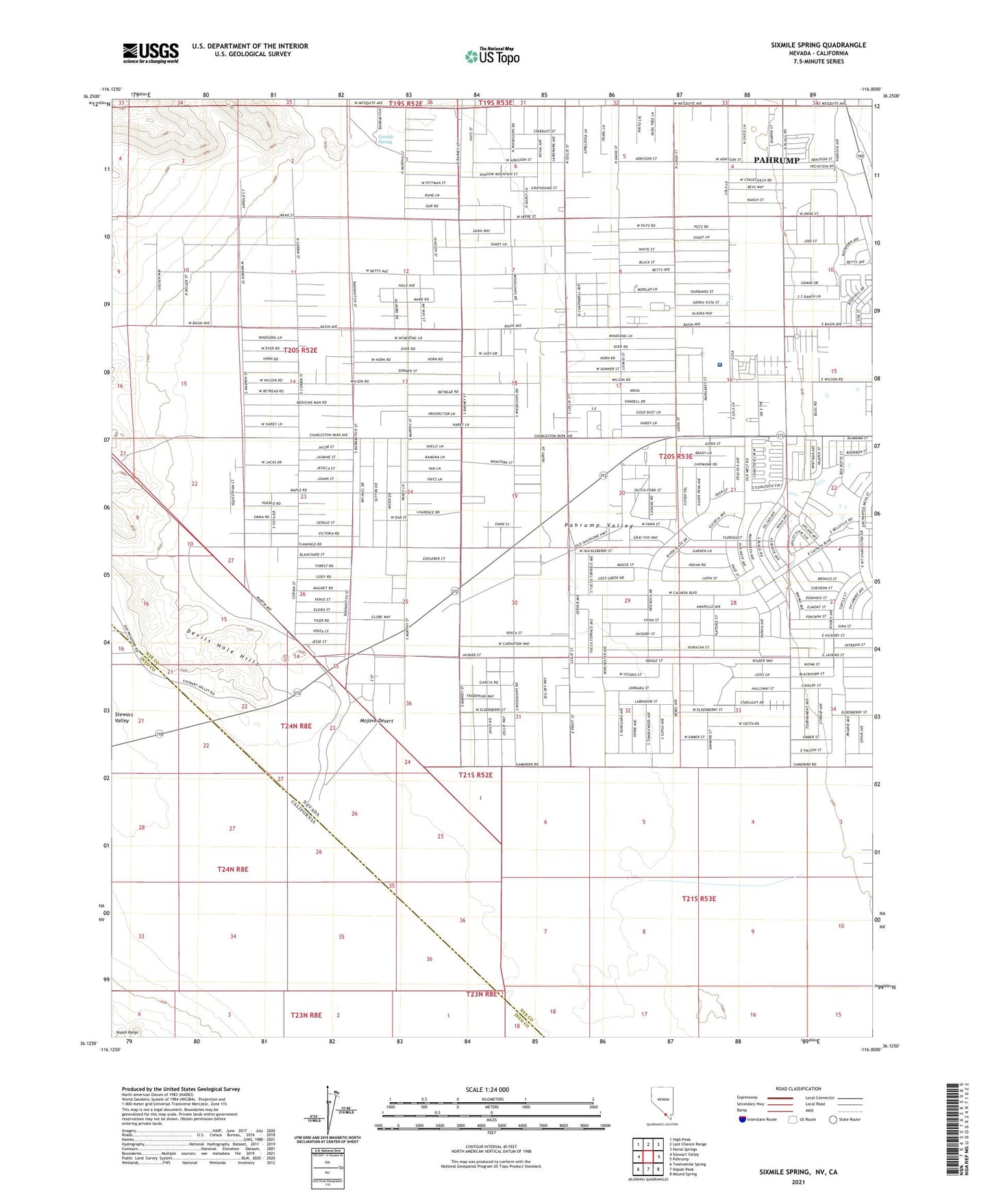
2021 topographic map quadrangle Sixmile Spring in the state of Nevada. Scale: 1:24000. Based on the newly updated USGS 7.5' US Topo map series, this map is in the following counties: Nye, Inyo. The map contains contour data, water features, and other items you are used to seeing on USGS maps, but also has updated roads and other features. This is the next generation of topographic maps. Printed on high-quality waterproof paper with UV fade-resistant inks.
Quads adjacent to this one:
West: Stewart Valley
Northwest: High Peak
North: Last Chance Range
Northeast: Horse Springs
East: Pahrump
Southeast: Mound Spring
South: Nopah Peak
Southwest: Twelvemile Spring
This map covers the same area as the classic USGS quad with code o36116b1.
Contains the following named places: Cayton Well, Community Christian Academy, Community College of Southern Nevada Pahrump Valley Center, Desert View Hospital, Great Basin College Pahrump Valley Center, Sixmile Spring, ZIP Code: 89048