MyTopo
Mount Stirling Nevada US Topo Map
Couldn't load pickup availability
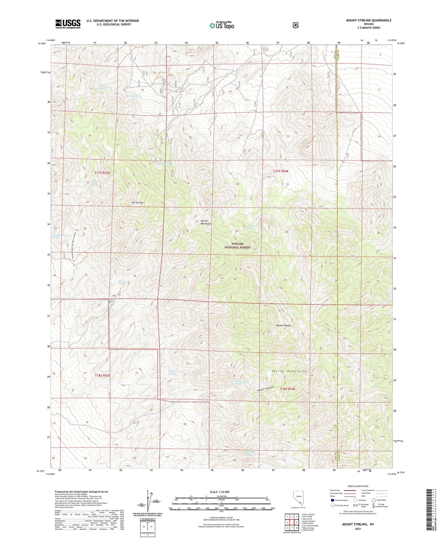
2021 topographic map quadrangle Mount Stirling in the state of Nevada. Scale: 1:24000. Based on the newly updated USGS 7.5' US Topo map series, this map is in the following counties: Nye, Clark. The map contains contour data, water features, and other items you are used to seeing on USGS maps, but also has updated roads and other features. This is the next generation of topographic maps. Printed on high-quality waterproof paper with UV fade-resistant inks.
Quads adjacent to this one:
West: Mount Schader
Northwest: Point of Rocks
North: Niavi Wash
East: Willow Peak
Southeast: Wheeler Well
South: Horse Springs
Southwest: Last Chance Range
Contains the following named places: Big Timber Spring, Bill Smith Springs, Crystal Spring, Gold Spring, Jaybird Spring, Mount Stirling, Pah Rump Spring, Rainbow Springs, Rock Spring, Stirling, Stirling Mine, Stirling Post Office, Wood Canyon, Wood Canyon Spring