MyTopo
Last Chance Range Nevada US Topo Map
Couldn't load pickup availability
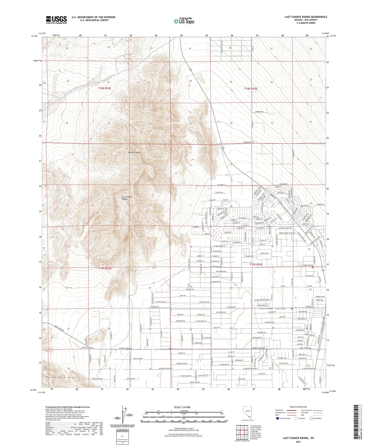
2021 topographic map quadrangle Last Chance Range in the state of Nevada. Scale: 1:24000. Based on the newly updated USGS 7.5' US Topo map series, this map is in the following counties: Nye. The map contains contour data, water features, and other items you are used to seeing on USGS maps, but also has updated roads and other features. This is the next generation of topographic maps. Printed on high-quality waterproof paper with UV fade-resistant inks.
Quads adjacent to this one:
West: High Peak
Northwest: Amargosa Flat
North: Mount Schader
Northeast: Mount Stirling
East: Horse Springs
Southeast: Pahrump
South: Sixmile Spring
Southwest: Stewart Valley
This map covers the same area as the classic USGS quad with code o36116c1.
Contains the following named places: Brady Ranch, Evergreen Pahrump Hospital, Fowler Ranch, Garlin Ranch, Last Chance Range, Manse Elementary School, Pahrump Valley Fire and Rescue Station 2, Pahrump Valley Fire and Rescue Station 5, Precious Materials Heliport, Rosemary Clarke Middle School, Simkins Post Office, Wilcox Well