MyTopo
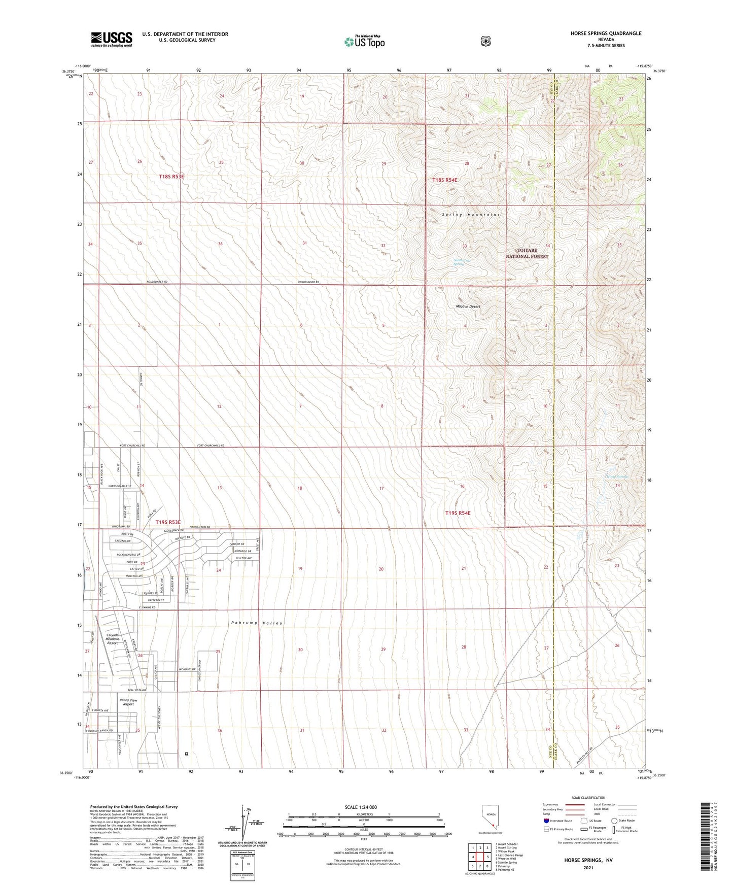
Horse Springs Nevada US Topo Map
Couldn't load pickup availability
Also explore the Horse Springs Forest Service Topo of this same quad for updated USFS data
2021 topographic map quadrangle Horse Springs in the state of Nevada. Scale: 1:24000. Based on the newly updated USGS 7.5' US Topo map series, this map is in the following counties: Nye, Clark. The map contains contour data, water features, and other items you are used to seeing on USGS maps, but also has updated roads and other features. This is the next generation of topographic maps. Printed on high-quality waterproof paper with UV fade-resistant inks.
Quads adjacent to this one:
West: Last Chance Range
Northwest: Mount Schader
North: Mount Stirling
Northeast: Willow Peak
East: Wheeler Well
Southeast: Pahrump NE
South: Pahrump
Southwest: Sixmile Spring
This map covers the same area as the classic USGS quad with code o36115c8.
Contains the following named places: Calvada Meadows Airport, Flying S Ranch Ultralight Flightpark, Horse Springs, Ray Vanhorn Farm, Santa Cruz Spring, Simpkins Daniels Ranch, Valley View Airport