
MyTopo
Willow Beach Arizona US Topo Map
Couldn't load pickup availability
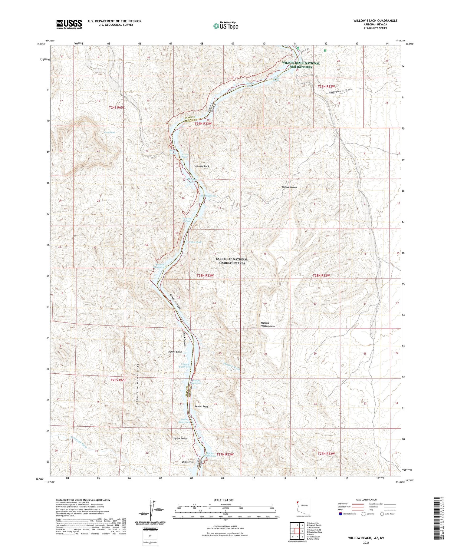
2023 topographic map quadrangle Willow Beach in the states of Arizona, Nevada. Scale: 1:24000. Based on the newly updated USGS 7.5' US Topo map series, this map is in the following counties: Mohave, Clark. The map contains contour data, water features, and other items you are used to seeing on USGS maps, but also has updated roads and other features. This is the next generation of topographic maps. Printed on high-quality waterproof paper with UV fade-resistant inks.
Quads adjacent to this one:
West: Boulder City SE
Northwest: Boulder City
North: Ringbolt Rapids
Northeast: Mount Wilson
East: Housholder Pass
Southeast: Mohave Mine
South: Fire Mountain
Southwest: Nelson
Contains the following named places: Big Horn Cove, Black Canyon, Burro Wash, Chalk Cliffs, Copper Basin, Copper Basin Cove, Double Neck Cove, Fenlon Bend, Fenlon Bend Cove, Grotto Wash, Hills Camp, Jumbo Wash, Latos Pools, Malpais Flattop Mesa, Malpais Wash, Monkey Hole, Monkey Rock, Nevada Sheep Cove, Painted 8 Cove, Quenos Cove, Roaring Rapids, Shallow Rapids, Squaw Peaks, Squaw Peaks Cove, Willow Beach, Willow Beach Sub-District Ranger Station, Windy Canyon


