MyTopo
Pahroc Spring Nevada US Topo Map
Couldn't load pickup availability
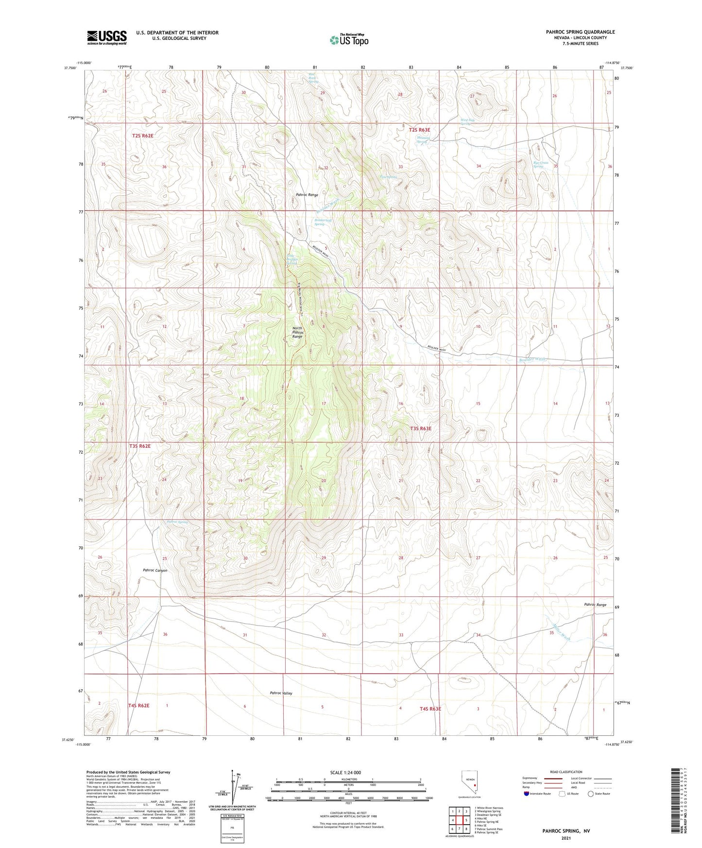
2021 topographic map quadrangle Pahroc Spring in the state of Nevada. Scale: 1:24000. Based on the newly updated USGS 7.5' US Topo map series, this map is in the following counties: Lincoln. The map contains contour data, water features, and other items you are used to seeing on USGS maps, but also has updated roads and other features. This is the next generation of topographic maps. Printed on high-quality waterproof paper with UV fade-resistant inks.
Quads adjacent to this one:
West: Hiko NE
Northwest: White River Narrows
North: Wheatgrass Spring
Northeast: Deadman Spring SE
East: Pahroc Spring NE
Southeast: Pahroc Spring SE
South: Pahroc Summit Pass
Southwest: Hiko SE
This map covers the same area as the classic USGS quad with code o37114f8.
Contains the following named places: Big Rocks Wilderness, Brinkerhoff Spring, Lincoln County, Little Boulder Spring, Mustang Spring, North Pahroc Range, Pahroc Canyon, Pahroc Range, Pahroc Spring, Pine Spring, Rye Grass Spring, West Side Spring