MyTopo
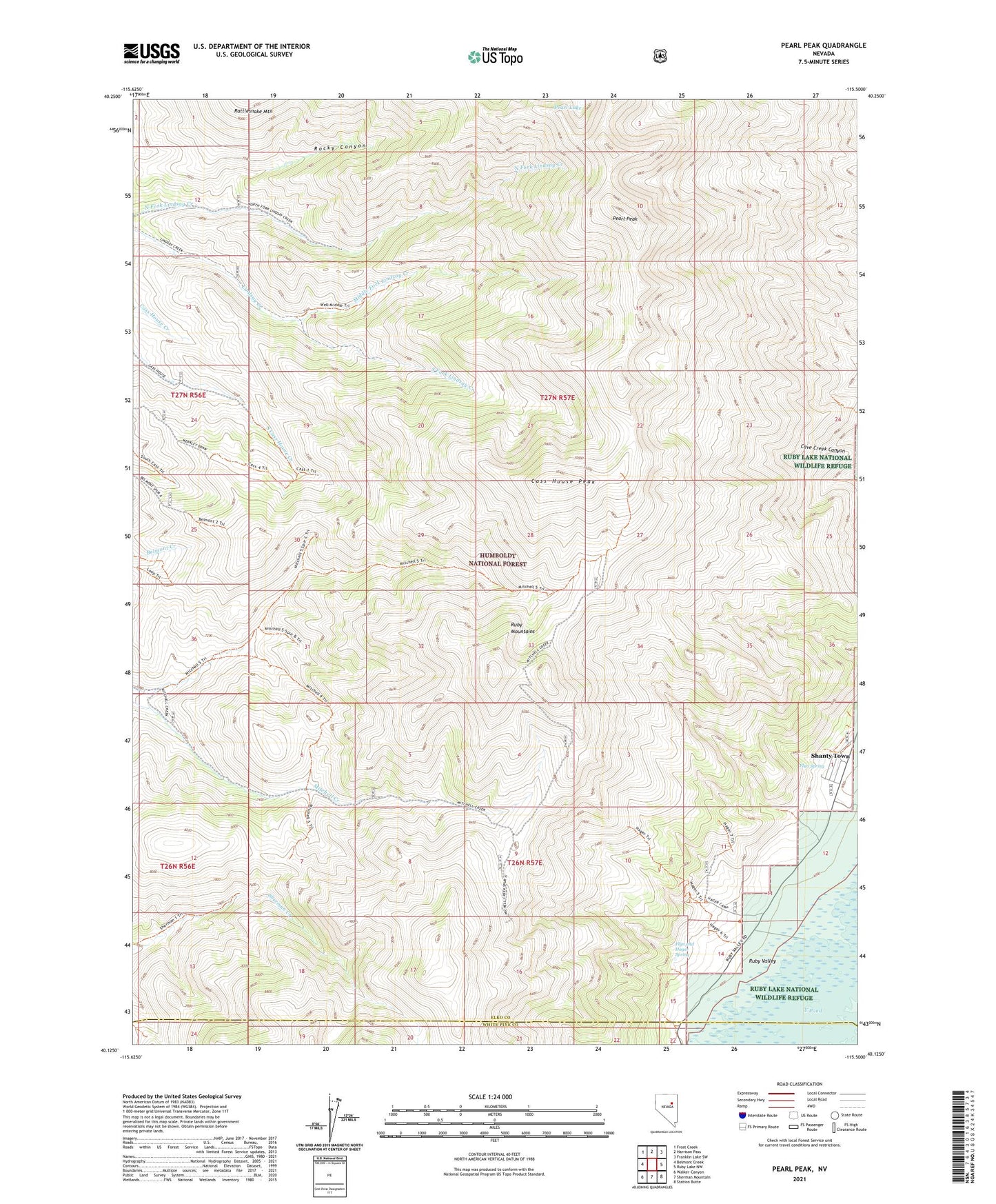
Pearl Peak Nevada US Topo Map
Couldn't load pickup availability
Also explore the Pearl Peak Forest Service Topo of this same quad for updated USFS data
2021 topographic map quadrangle Pearl Peak in the state of Nevada. Scale: 1:24000. Based on the newly updated USGS 7.5' US Topo map series, this map is in the following counties: Elko, White Pine. The map contains contour data, water features, and other items you are used to seeing on USGS maps, but also has updated roads and other features. This is the next generation of topographic maps. Printed on high-quality waterproof paper with UV fade-resistant inks.
Quads adjacent to this one:
West: Belmont Creek
Northwest: Frost Creek
North: Harrison Pass
Northeast: Franklin Lake SW
East: Ruby Lake NW
Southeast: Station Butte
South: Sherman Mountain
Southwest: Walker Canyon
This map covers the same area as the classic USGS quad with code o40115b5.
Contains the following named places: Cass House Peak, Cave Creek Mining District, De Witt Mine, Flyn and Hager Spring, Flyn Spring, Middle Fork Lindsay Creek, Pearl Lake, Pearl Peak, Rocky Canyon, Shanty Town, South Fork Lindsay Creek, Uncle Sam Mine