MyTopo
Preston Reservoir Nevada US Topo Map
Couldn't load pickup availability
Also explore the Preston Reservoir Forest Service Topo of this same quad for updated USFS data
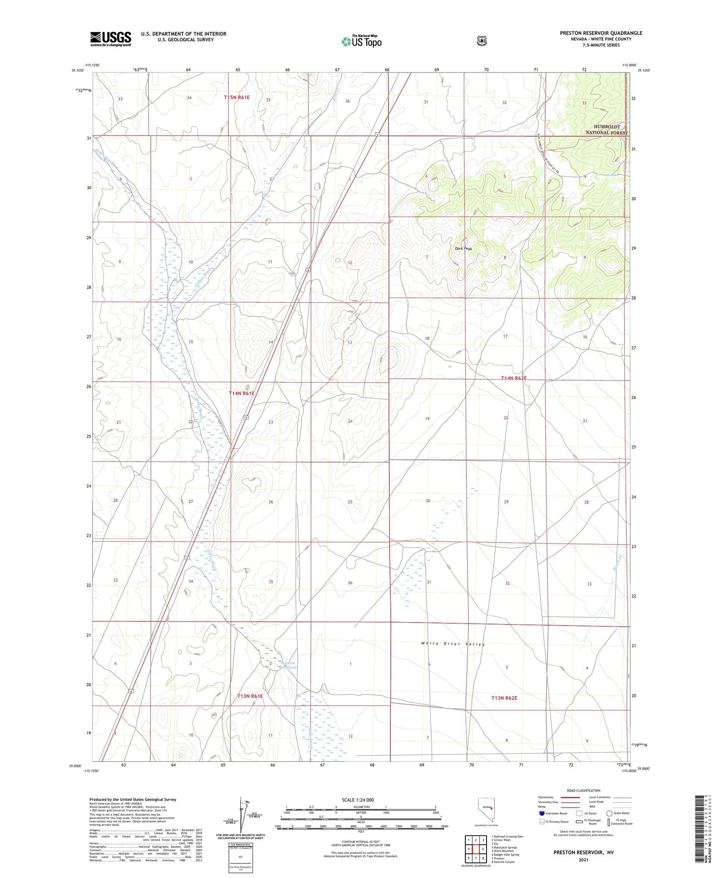
2021 topographic map quadrangle Preston Reservoir in the state of Nevada. Scale: 1:24000. Based on the newly updated USGS 7.5' US Topo map series, this map is in the following counties: White Pine. The map contains contour data, water features, and other items you are used to seeing on USGS maps, but also has updated roads and other features. This is the next generation of topographic maps. Printed on high-quality waterproof paper with UV fade-resistant inks.
Quads adjacent to this one:
West: Blackjack Springs
Northwest: Railroad Crossing Dam
North: Giroux Wash
Northeast: Ely
East: Ward Mountain
Southeast: Sawmill Canyon
South: Preston
Southwest: Badger Hole Spring
This map covers the same area as the classic USGS quad with code o39115a1.
Contains the following named places: Dark Peak, Giroux Wash, Giroux Wash Reservoir, Holt Creek, Jakes Wash Well, Preston Dam, Preston Reservoir, Preston Seeding Windmill, Rowe Creek