MyTopo
Rattlesnake Mountain Nevada US Topo Map
Couldn't load pickup availability
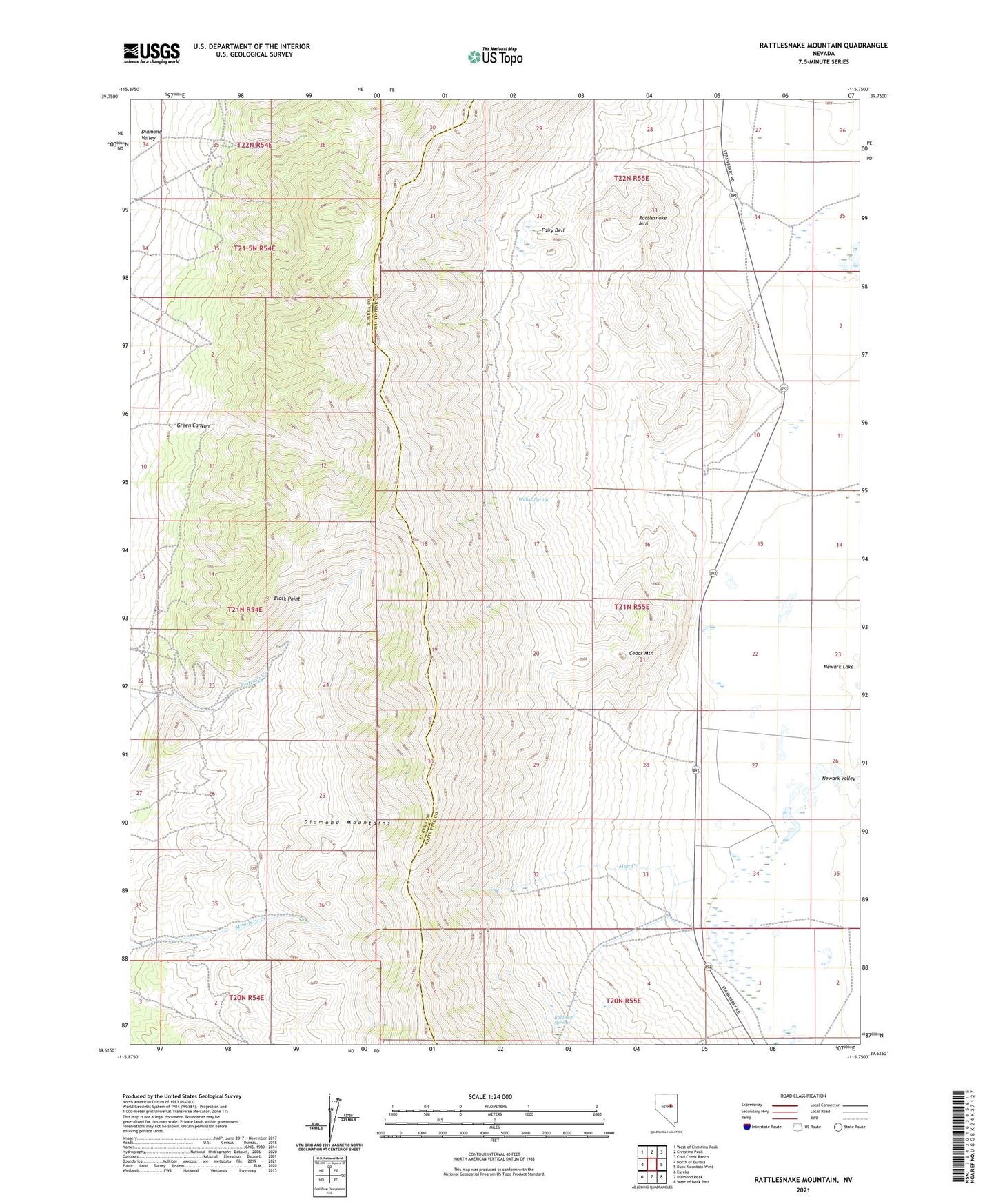
2021 topographic map quadrangle Rattlesnake Mountain in the state of Nevada. Scale: 1:24000. Based on the newly updated USGS 7.5' US Topo map series, this map is in the following counties: White Pine, Eureka. The map contains contour data, water features, and other items you are used to seeing on USGS maps, but also has updated roads and other features. This is the next generation of topographic maps. Printed on high-quality waterproof paper with UV fade-resistant inks.
Quads adjacent to this one:
West: North of Eureka
Northwest: West of Christina Peak
North: Christina Peak
Northeast: Cold Creek Ranch
East: Buck Mountain West
Southeast: West of Beck Pass
South: Diamond Peak
Southwest: Eureka
Contains the following named places: Black Point, Black Point Mine, Carp Post Office, Cedar Mountain, Champion Mine, Curtis Mine, Diamond City, Diamond Mining District, Diamond Mountains, Eldridge Ranch, Fairy Dell, Green Canyon, Hidden Treasure Mine, Keller Mine, Mammoth Mine, Mau Creek, Patriot Mine, Phillipsburg Mine, Rattlesnake Mountain, Robinson Springs, Silver Bell Mine, Standard Copper Mine, Strawberry, Strawberry Post Office, Strawberry Ranch, Willow Spring