MyTopo
Christina Peak Nevada US Topo Map
Couldn't load pickup availability
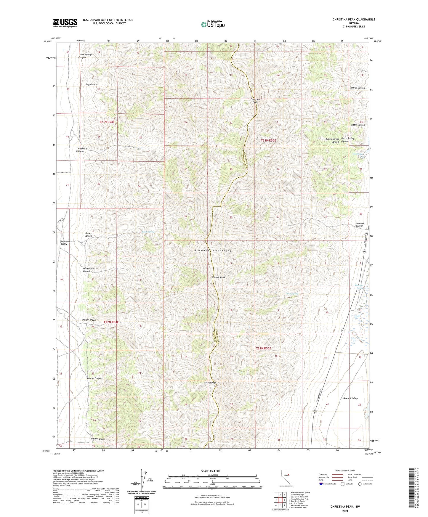
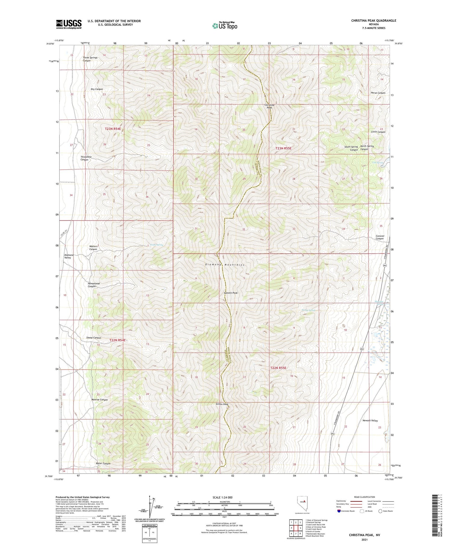
2021 topographic map quadrangle Christina Peak in the state of Nevada. Scale: 1:24000. Based on the newly updated USGS 7.5' US Topo map series, this map is in the following counties: Eureka, White Pine. The map contains contour data, water features, and other items you are used to seeing on USGS maps, but also has updated roads and other features. This is the next generation of topographic maps. Printed on high-quality waterproof paper with UV fade-resistant inks.
Quads adjacent to this one:
West: West of Christina Peak
Northwest: West of Diamond Springs
North: Diamond Springs
Northeast: Cold Creek Ranch NW
East: Cold Creek Ranch
Southeast: Buck Mountain West
South: Rattlesnake Mountain
Southwest: North of Eureka
This map covers the same area as the classic USGS quad with code o39115g7.
Contains the following named places: Christina Peak, Cole Spring, Conover Canyon, Dry Canyon, Gilson Peak, Goicoechea Ranch, Handy Spring, Homestead Canyon, Horse Canyon, Little Canyon, Maggini Ranch, Minoletti Spring, Monroe Canyon, North Spring Canyon, Potato Spring, Sheep Canyon, South Spring Canyon, Steel Galena Mine, Summit Peak, Three Springs Canyon, Threemile Canyon, Walters Canyon, Water Canyon