MyTopo
Red Butte Nevada US Topo Map
Couldn't load pickup availability
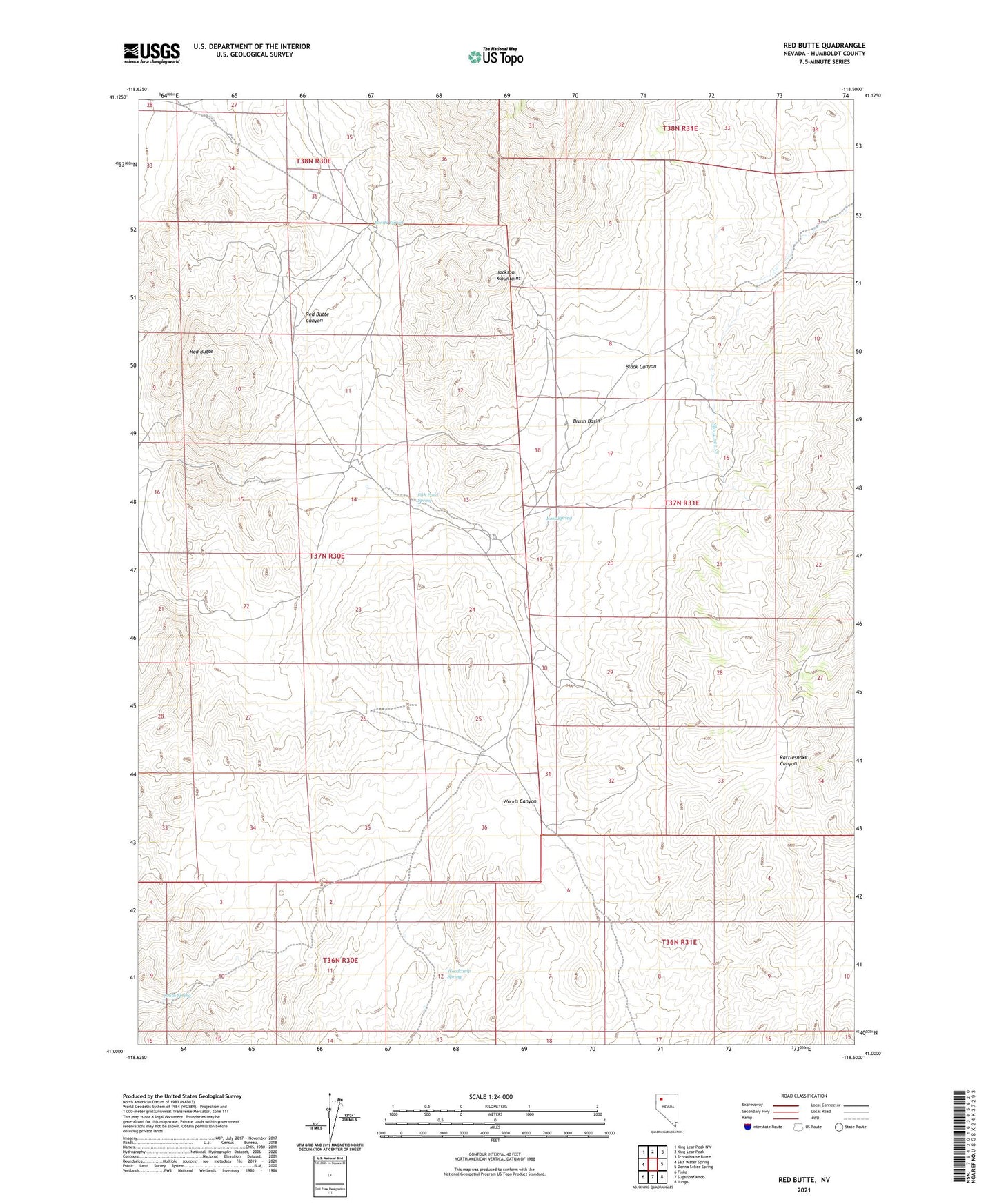
2021 topographic map quadrangle Red Butte in the state of Nevada. Scale: 1:24000. Based on the newly updated USGS 7.5' US Topo map series, this map is in the following counties: Humboldt. The map contains contour data, water features, and other items you are used to seeing on USGS maps, but also has updated roads and other features. This is the next generation of topographic maps. Printed on high-quality waterproof paper with UV fade-resistant inks.
Quads adjacent to this one:
West: Salt Water Spring
Northwest: King Lear Peak NW
North: King Lear Peak
Northeast: Schoolhouse Butte
East: Donna Schee Spring
Southeast: Jungo
South: Sugarloaf Knob
Southwest: Floka
This map covers the same area as the classic USGS quad with code o41118a5.
Contains the following named places: Bonita Spring, Brush Basin, Fish Pond Spring, Green Elephant Mine, Red Butte, Red Butte Mine, Red Butte Mining District, Rock Spring, South Spring, Stroud Mine, Woodcamp Spring