MyTopo
Schoolhouse Butte Nevada US Topo Map
Couldn't load pickup availability
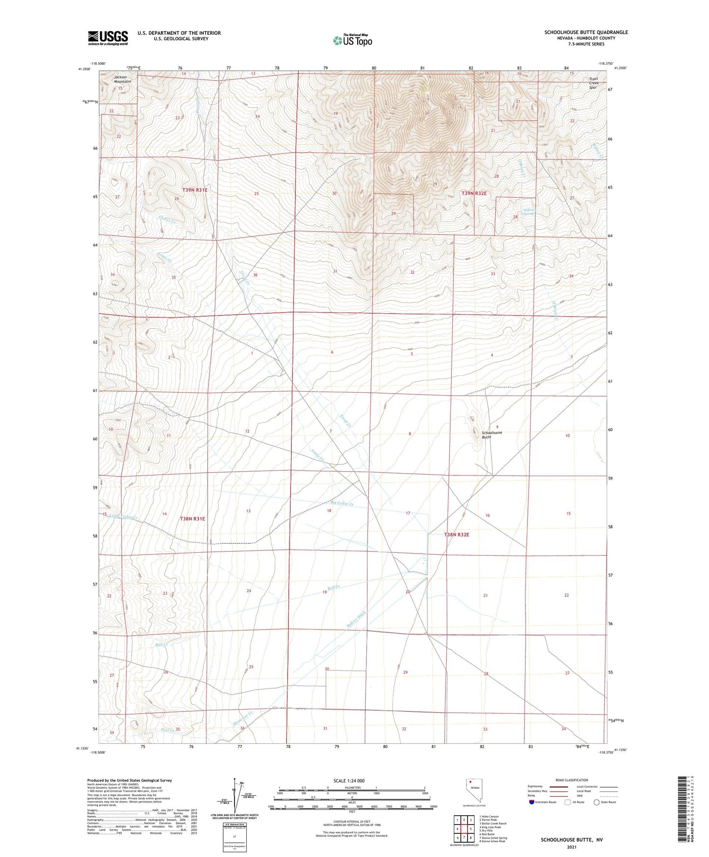
2021 topographic map quadrangle Schoolhouse Butte in the state of Nevada. Scale: 1:24000. Based on the newly updated USGS 7.5' US Topo map series, this map is in the following counties: Humboldt. The map contains contour data, water features, and other items you are used to seeing on USGS maps, but also has updated roads and other features. This is the next generation of topographic maps. Printed on high-quality waterproof paper with UV fade-resistant inks.
Quads adjacent to this one:
West: King Lear Peak
Northwest: Hobo Canyon
North: Parrot Peak
Northeast: Bottle Creek Ranch
East: Dry Hills
Southeast: Donna Schee Peak
South: Donna Schee Spring
Southwest: Red Butte
This map covers the same area as the classic USGS quad with code o41118b4.
Contains the following named places: Big Cedar Creek, Big Cedar Creek Ditch, Bull Creek, Bull Creek Ditch, Clover Creek, Little Cedar Creek, Little Cedar Creek Ditch, Louse Creek, Post Creek, Schoolhouse Butte, Shawnee Creek, Trout Creek, Trout Creek Ranch, Willows Spring