MyTopo
Red Rock Canyon Nevada US Topo Map
Couldn't load pickup availability
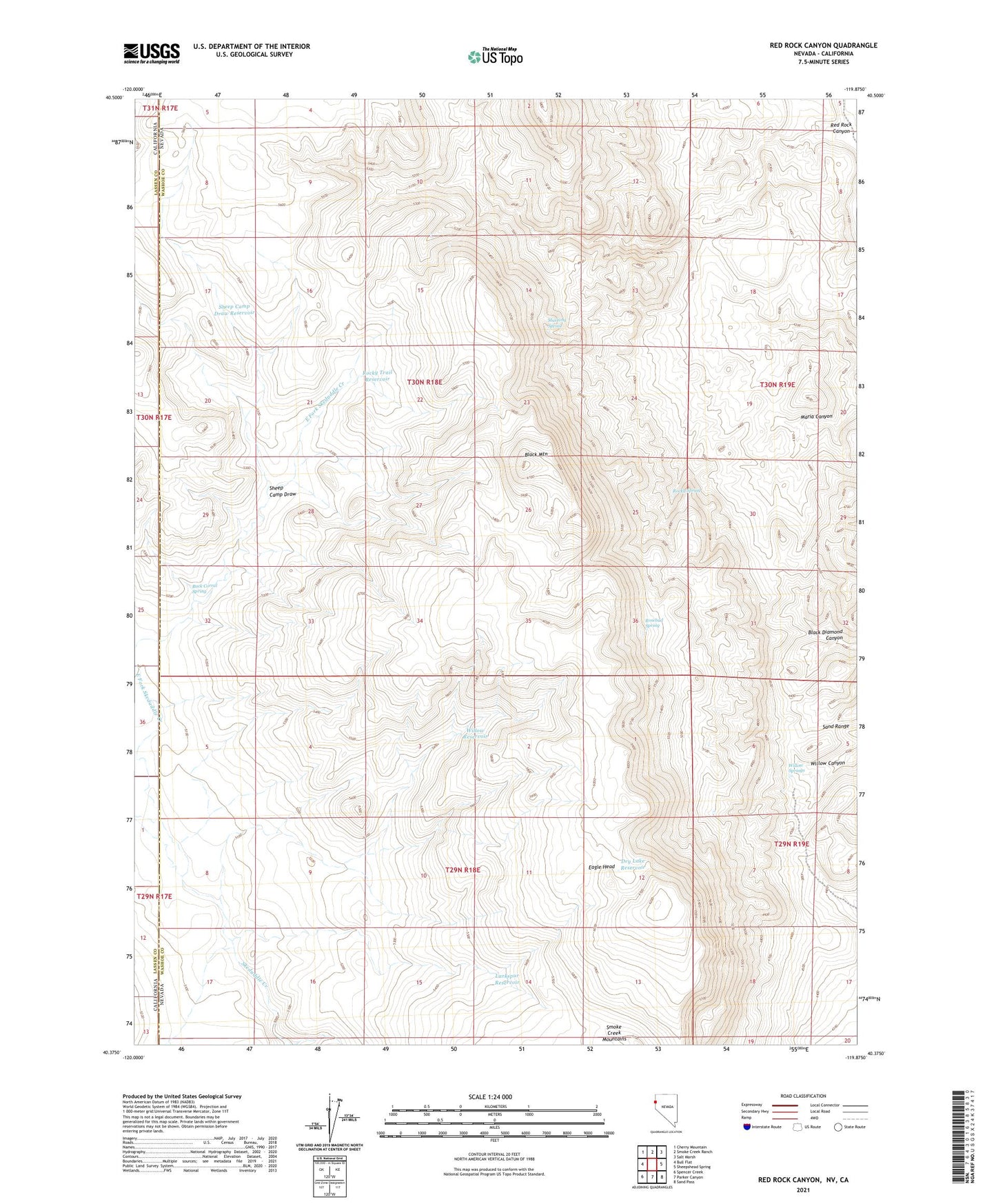
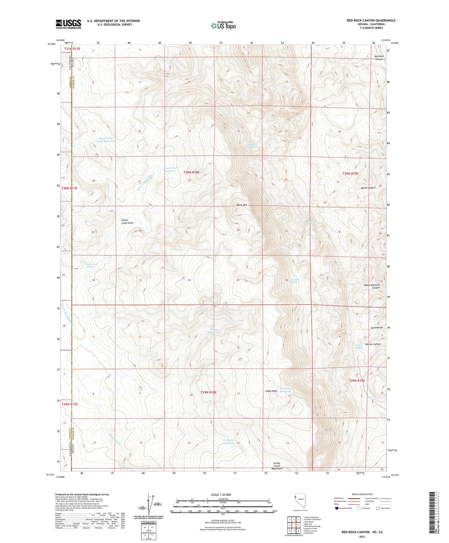
2021 topographic map quadrangle Red Rock Canyon in the state of Nevada. Scale: 1:24000. Based on the newly updated USGS 7.5' US Topo map series, this map is in the following counties: Washoe, Lassen. The map contains contour data, water features, and other items you are used to seeing on USGS maps, but also has updated roads and other features. This is the next generation of topographic maps. Printed on high-quality waterproof paper with UV fade-resistant inks.
Quads adjacent to this one:
West: Bull Flat
Northwest: Cherry Mountain
North: Smoke Creek Ranch
Northeast: Salt Marsh
East: Sheepshead Spring
Southeast: Sand Pass
South: Parker Canyon
Southwest: Spencer Creek
Contains the following named places: Black Mountain, Buck Corral Spring, Dry Lake Reservoir, Eagle Head, East Fork Skedaddle Creek, Larkspur Reservoir, Mustang Spring, Red Rock Canyon, Rocky Spring, Rocky Trail Reservoir, Rosebud Spring, Sheep Camp Draw, Sheep Camp Draw Reservoir, Willow Reservoir, Willow Springs