MyTopo
Butler Mountain Nevada US Topo Map
Couldn't load pickup availability
Also explore the Butler Mountain Forest Service Topo of this same quad for updated USFS data
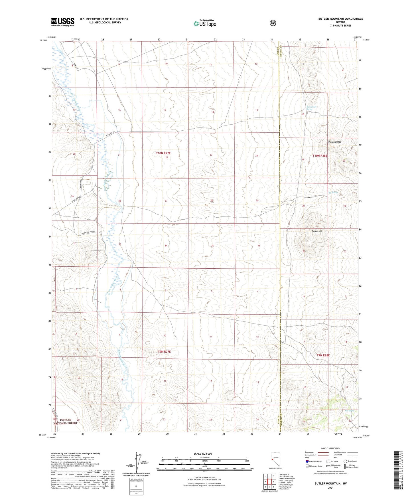
2021 topographic map quadrangle Butler Mountain in the state of Nevada. Scale: 1:24000. Based on the newly updated USGS 7.5' US Topo map series, this map is in the following counties: Lyon, Mineral. The map contains contour data, water features, and other items you are used to seeing on USGS maps, but also has updated roads and other features. This is the next generation of topographic maps. Printed on high-quality waterproof paper with UV fade-resistant inks.
Quads adjacent to this one:
West: Pine Grove Spring
Northwest: Yerington SE
North: Buckbrush Spring
Northeast: Reese River Canyon
East: Copper Canyon
Southeast: Mount Grant
South: Mitchell Spring
Southwest: Wichman Canyon
This map covers the same area as the classic USGS quad with code o38118f8.
Contains the following named places: Big Spring, Box Spring, Buck Brush Spring, Butler Mountain, Durants Mill, Rafter Seven Ranch, Rowe Ranch, Santa Margarita Ranch, Wheelers