MyTopo
Riverside Nevada US Topo Map
Couldn't load pickup availability
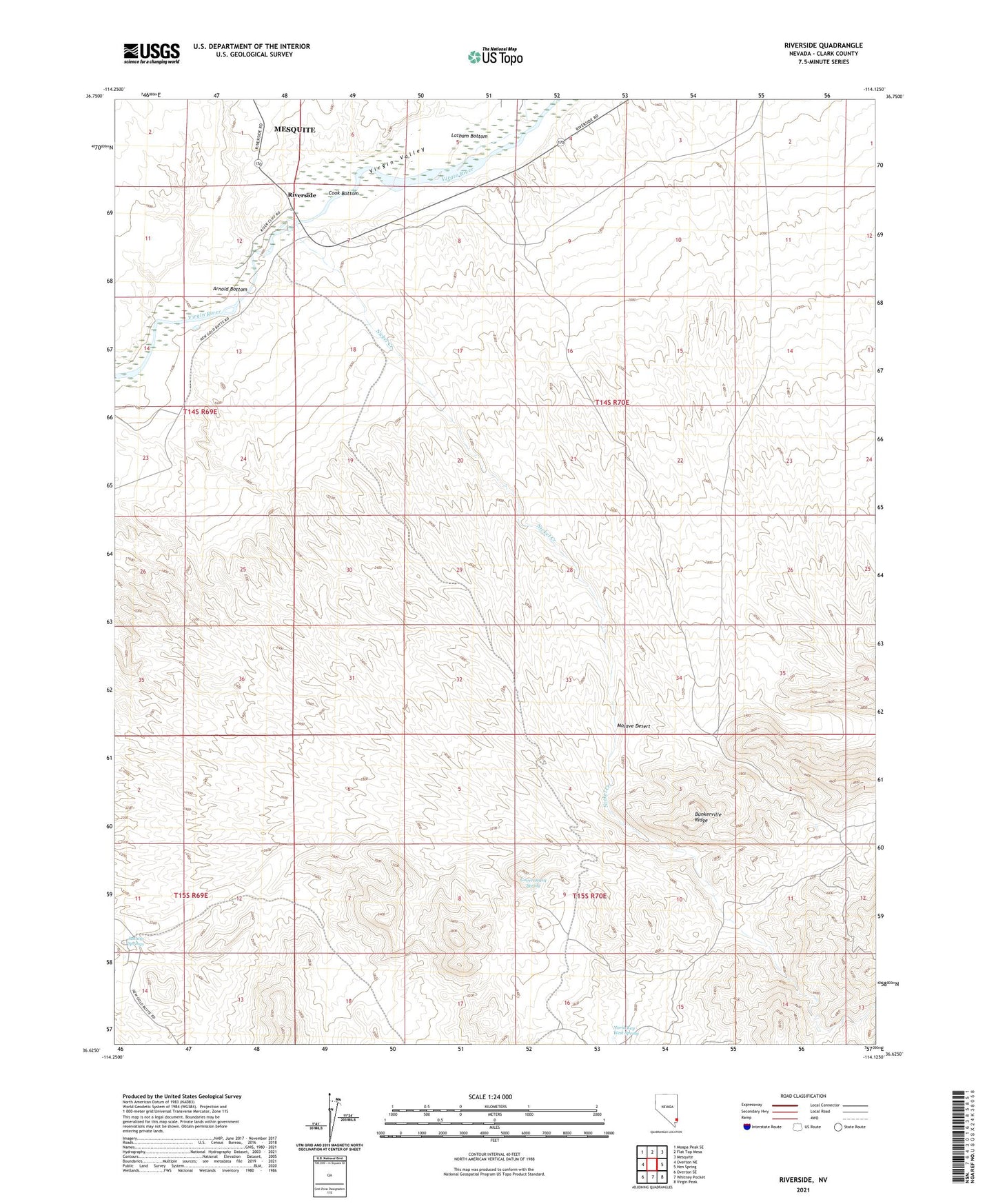
2021 topographic map quadrangle Riverside in the state of Nevada. Scale: 1:24000. Based on the newly updated USGS 7.5' US Topo map series, this map is in the following counties: Clark. The map contains contour data, water features, and other items you are used to seeing on USGS maps, but also has updated roads and other features. This is the next generation of topographic maps. Printed on high-quality waterproof paper with UV fade-resistant inks.
Quads adjacent to this one:
West: Overton NE
Northwest: Moapa Peak SE
North: Flat Top Mesa
Northeast: Mesquite
East: Hen Spring
Southeast: Virgin Peak
South: Whitney Pocket
Southwest: Overton SE
This map covers the same area as the classic USGS quad with code o36114f2.
Contains the following named places: Arnold Bottom, Bunkerville Ridge, Bunkerville Township, Camp Vida, Cook Bottom, Cottonwood, David Buddy Ranch, Foster Ranch, Frank Taylor Ranch, Government Spring, Juanita Springs, Juanita Springs Ranch, Latham Bottom, Nickel Creek, North Key West Spring, Riverside, Virgin River Recreation Area, ZIP Code: 89007