MyTopo
Rodeo Creek NE Nevada US Topo Map
Couldn't load pickup availability
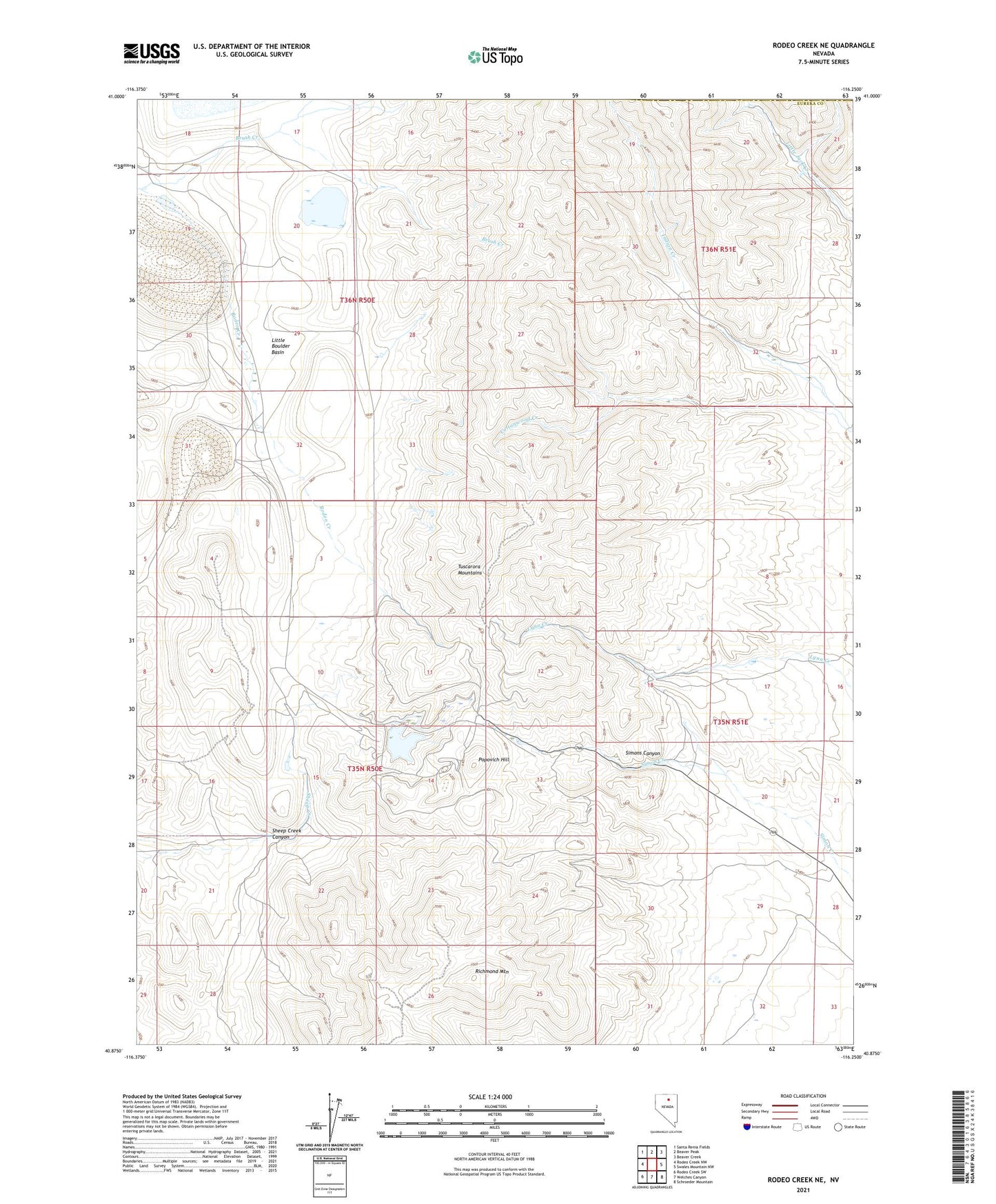
2021 topographic map quadrangle Rodeo Creek NE in the state of Nevada. Scale: 1:24000. Based on the newly updated USGS 7.5' US Topo map series, this map is in the following counties: Eureka, Elko. The map contains contour data, water features, and other items you are used to seeing on USGS maps, but also has updated roads and other features. This is the next generation of topographic maps. Printed on high-quality waterproof paper with UV fade-resistant inks.
Quads adjacent to this one:
West: Rodeo Creek NW
Northwest: Santa Renia Fields
North: Beaver Peak
Northeast: Beaver Creek
East: Swales Mountain NW
Southeast: Schroeder Mountain
South: Welches Canyon
Southwest: Rodeo Creek SW
This map covers the same area as the classic USGS quad with code o40116h3.
Contains the following named places: Barrick Goldstrike Ambulance Service, Big Six Mine, Blue Star Mine, Brush Creek, Carlin Mine, Carlin Mine Dam, Goldville, Goldville Post Office, Leeville, Little Boulder Basin, Lynn Creek Placer Mines, Lynn Mining District, Newmont Mine, Popovich Hill, Richmond Mountain, Rodeo Creek Placer Mines, Rodeo Reservoir Dam, Sheep Creek Canyon, Sheep Creek Placer Mines, Simons Canyon