MyTopo
Rose Valley Nevada US Topo Map
Couldn't load pickup availability
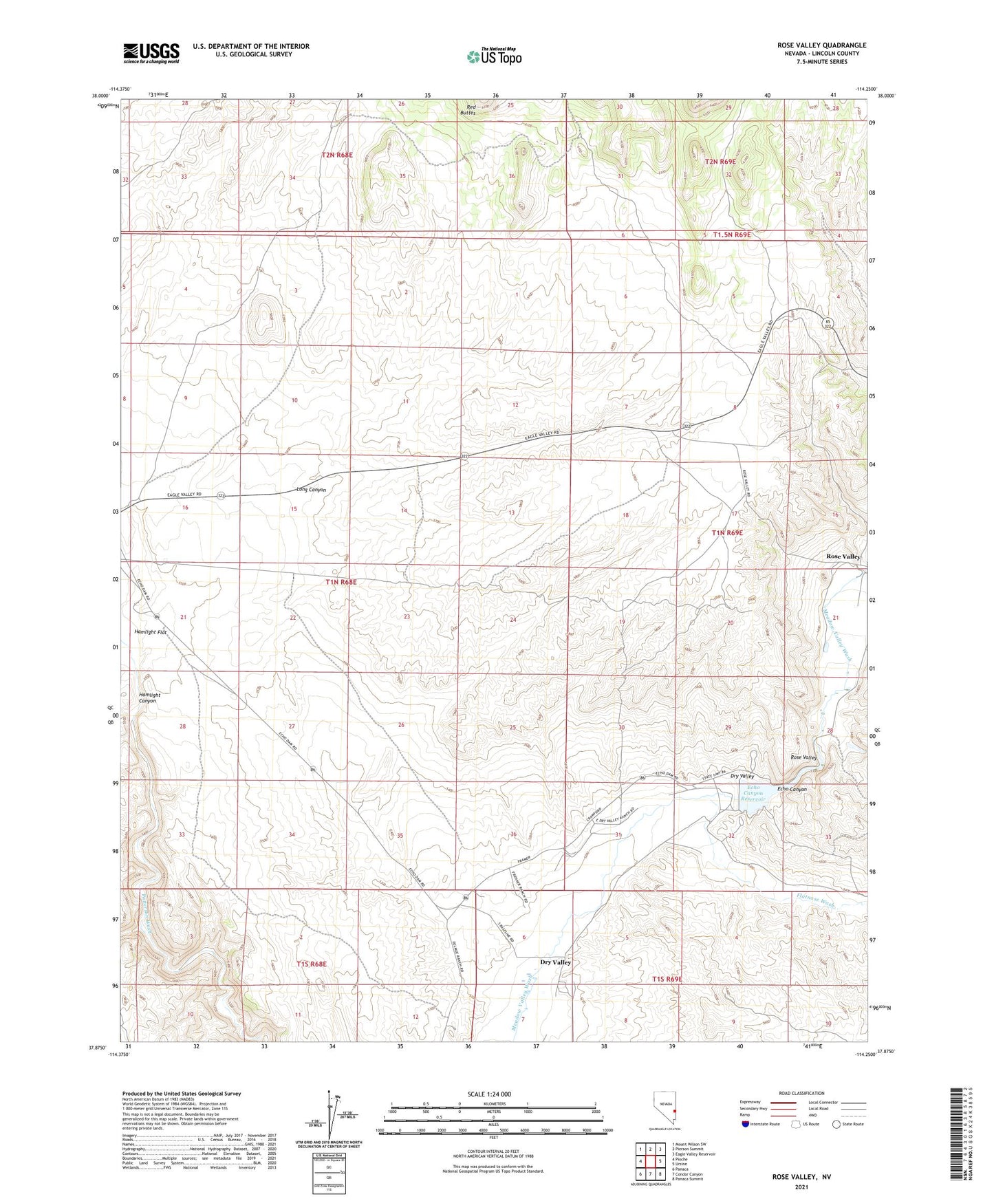
2021 topographic map quadrangle Rose Valley in the state of Nevada. Scale: 1:24000. Based on the newly updated USGS 7.5' US Topo map series, this map is in the following counties: Lincoln. The map contains contour data, water features, and other items you are used to seeing on USGS maps, but also has updated roads and other features. This is the next generation of topographic maps. Printed on high-quality waterproof paper with UV fade-resistant inks.
Quads adjacent to this one:
West: Pioche
Northwest: Mount Wilson SW
North: Pierson Summit
Northeast: Eagle Valley Reservoir
East: Ursine
Southeast: Panaca Summit
South: Condor Canyon
Southwest: Panaca
This map covers the same area as the classic USGS quad with code o37114h3.
Contains the following named places: Dry Valley Census Designated Place, Echo Canyon, Echo Canyon Dam, Echo Canyon Reservoir, Echo Canyon Reservoir State Recreation Area, Engadine Post Office, Flat Nose, Flatnose Wash, Ham Lights Station, Hamlight Flat, Long Canyon, Lyonsville, Moodyville, Rose Valley