MyTopo
Ruby Dome Nevada US Topo Map
Couldn't load pickup availability
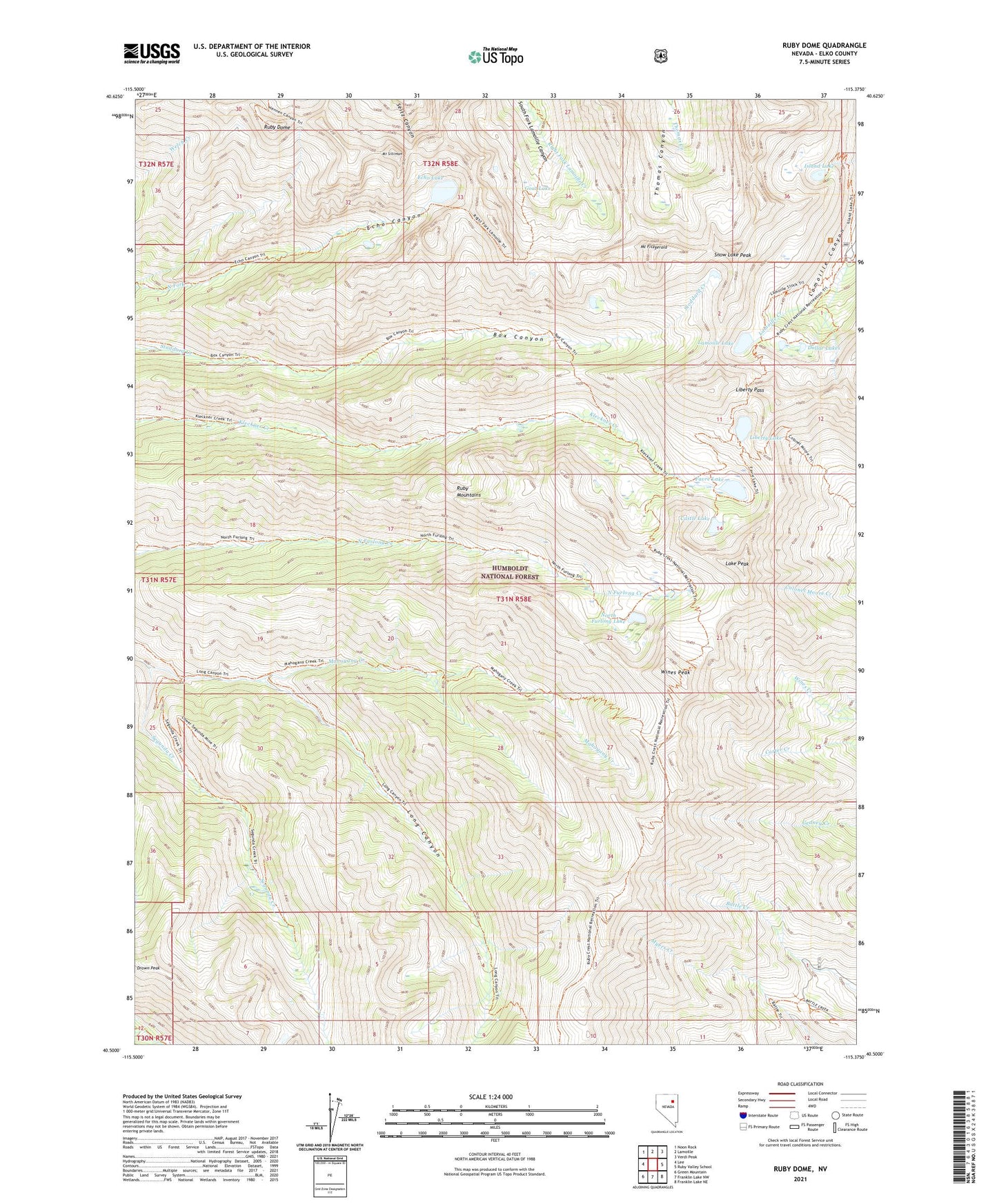
2021 topographic map quadrangle Ruby Dome in the state of Nevada. Scale: 1:24000. Based on the newly updated USGS 7.5' US Topo map series, this map is in the following counties: Elko. The map contains contour data, water features, and other items you are used to seeing on USGS maps, but also has updated roads and other features. This is the next generation of topographic maps. Printed on high-quality waterproof paper with UV fade-resistant inks.
Quads adjacent to this one:
West: Lee
Northwest: Noon Rock
North: Lamoille
Northeast: Verdi Peak
East: Ruby Valley School
Southeast: Franklin Lake NE
South: Franklin Lake NW
Southwest: Green Mountain
Contains the following named places: American Beauty Mine, Battle Creek Mines, Castle Lake, Dollar Lakes, Drown Peak, Echo Lake, Favre Lake, Goat Lake, Hargrove Mine, Island Lake, Lake Peak, Lamoille Lake, Liberty Lake, Liberty Pass, Mahogany Creek, Michigan Mine, Mount Fitzgerald, Mount Gilbert, Mount Silliman, North Furlong Lake, Roads End Picnicking Site, Ruby Crest National Recreation Trail Head, Ruby Dome, Ruby Mountain Ranger District, Ruby Mountains Scenic Area, Ruby Mountains Wilderness, Ruby Valley Mining District, Segunda Creek, Snow Lake Peak, Wines Peak