MyTopo
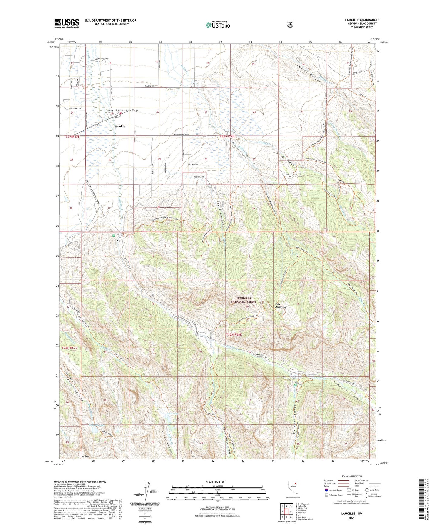
Lamoille Nevada US Topo Map
Couldn't load pickup availability
Also explore the Lamoille Forest Service Topo of this same quad for updated USFS data
2021 topographic map quadrangle Lamoille in the state of Nevada. Scale: 1:24000. Based on the newly updated USGS 7.5' US Topo map series, this map is in the following counties: Elko. The map contains contour data, water features, and other items you are used to seeing on USGS maps, but also has updated roads and other features. This is the next generation of topographic maps. Printed on high-quality waterproof paper with UV fade-resistant inks.
Quads adjacent to this one:
West: Noon Rock
Northwest: Boyd Reservoir
North: Halleck SW
Northeast: Soldier Peak
East: Verdi Peak
Southeast: Ruby Valley School
South: Ruby Dome
Southwest: Lee
This map covers the same area as the classic USGS quad with code o40115f4.
Contains the following named places: Camp Lamoille, Conrad Canyon, Conrad Creek, Griswold Lake, Lamoille, Lamoille Canyon, Lamoille Census Designated Place, Lamoille Post Office, Lamoille Station, Lamoille Volunteer Fire Department, Lee Miller Ranch, Lee Peak, Little Thorpe Creek, Powerhouse Picnic Area, Right Fork Lamoille Creek, Ruby Dome Ranch, Seitz Lake, Snell Canyon, Snell Creek, South Fork Lamoille Canyon, Thomas Canyon, Thomas Canyon Campground, Thomas Creek, Vignolo Ranch, Westlund Ranch