MyTopo
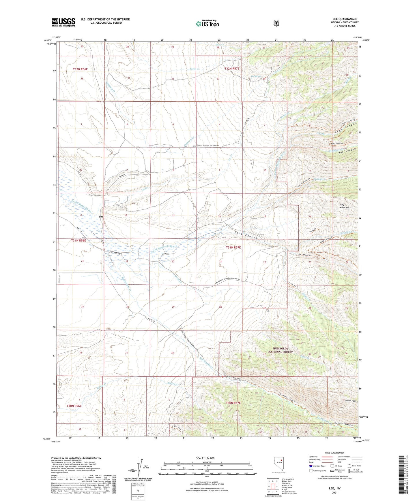
Lee Nevada US Topo Map
Couldn't load pickup availability
Also explore the Lee Forest Service Topo of this same quad for updated USFS data
2021 topographic map quadrangle Lee in the state of Nevada. Scale: 1:24000. Based on the newly updated USGS 7.5' US Topo map series, this map is in the following counties: Elko. The map contains contour data, water features, and other items you are used to seeing on USGS maps, but also has updated roads and other features. This is the next generation of topographic maps. Printed on high-quality waterproof paper with UV fade-resistant inks.
Quads adjacent to this one:
West: West of Lee
Northwest: Te-Moak Well
North: Noon Rock
Northeast: Lamoille
East: Ruby Dome
Southeast: Franklin Lake NW
South: Green Mountain
Southwest: Jiggs
This map covers the same area as the classic USGS quad with code o40115e5.
Contains the following named places: Box Canyon, Drown Creek, Echo Canyon, Gund Ranch, Kleckner Creek, Lee, Lee Creek, Lee Mining District, Lee Post Office, Lee Spring, Long Canyon, Magnuson Ranch, North Fork, North Furlong Creek, Pearl Creek, Rattlesnake Creek, South Fork Reservation, Stoddard Creek, Welch Creek, Wysong Ranch, ZIP Code: 89815