MyTopo
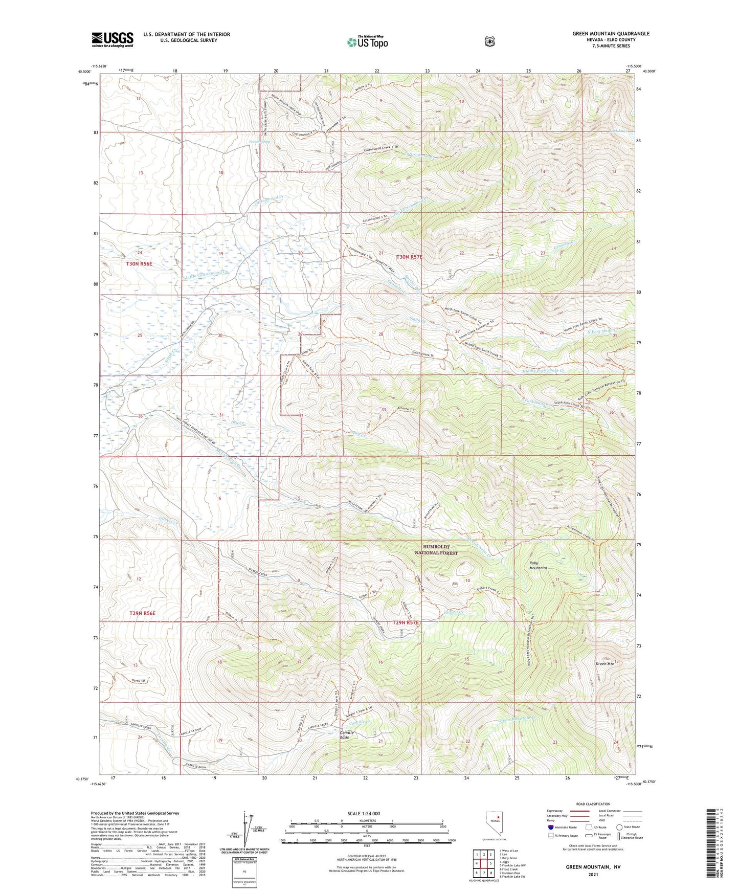
Green Mountain Nevada US Topo Map
Couldn't load pickup availability
Also explore the Green Mountain Forest Service Topo of this same quad for updated USFS data
2021 topographic map quadrangle Green Mountain in the state of Nevada. Scale: 1:24000. Based on the newly updated USGS 7.5' US Topo map series, this map is in the following counties: Elko. The map contains contour data, water features, and other items you are used to seeing on USGS maps, but also has updated roads and other features. This is the next generation of topographic maps. Printed on high-quality waterproof paper with UV fade-resistant inks.
Quads adjacent to this one:
West: Jiggs
Northwest: West of Lee
North: Lee
Northeast: Ruby Dome
East: Franklin Lake NW
Southeast: Franklin Lake SW
South: Harrison Pass
Southwest: Frost Creek
This map covers the same area as the classic USGS quad with code o40115d5.
Contains the following named places: Achurra Ranch, Carville Basin, Dry Creek, Dry Creek Post Office, Forest Spring, Gennette Creek, Green Mountain, Humboldt National Forest, Little Cottonwood Creek, Lost Lake, Merkley Ranch, Middle Fork Smith Creek, North Fork Smith Creek, O'Connells Ditch, Riordan Ranch, Smith Creek Ranch, Smith Creek School, Smith Creek Trail, South Fork Smith Creek, Suttles Ditch, Young Ranch