MyTopo
Sage Hen Spring Nevada US Topo Map
Couldn't load pickup availability
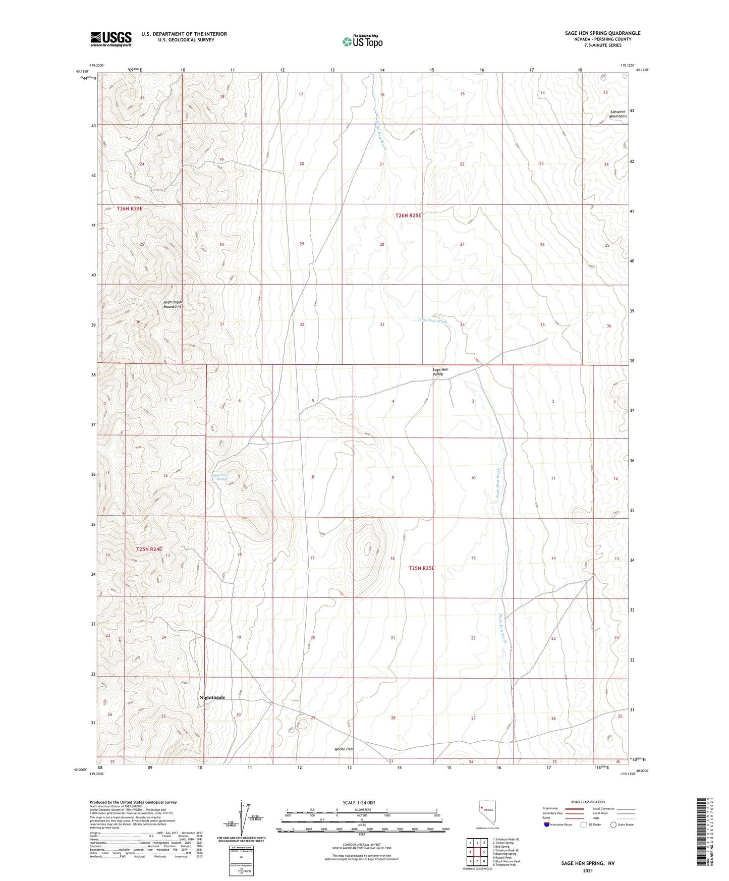
2021 topographic map quadrangle Sage Hen Spring in the state of Nevada. Scale: 1:24000. Based on the newly updated USGS 7.5' US Topo map series, this map is in the following counties: Pershing. The map contains contour data, water features, and other items you are used to seeing on USGS maps, but also has updated roads and other features. This is the next generation of topographic maps. Printed on high-quality waterproof paper with UV fade-resistant inks.
Quads adjacent to this one:
West: Tohakum Peak SE
Northwest: Tohakum Peak NE
North: Tunnel Spring
Northeast: Bob Spring
East: Bluewing Spring
Southeast: Telephone Well
South: Black Warrior Peak
Southwest: Russell Peak
This map covers the same area as the classic USGS quad with code o40119a2.
Contains the following named places: Alpine Mine, High Grade Mine, Lintons Well, Marvelous Mine, Nightingale, Nightingale Mine, Nightingale Mining District, Pershing Mine, Sage, Sage Hen Spring, Sage Hen Springs Mine, Sage Hen Valley, Two Chuckers Mine