MyTopo
San Antonio Ranch SW Nevada US Topo Map
Couldn't load pickup availability
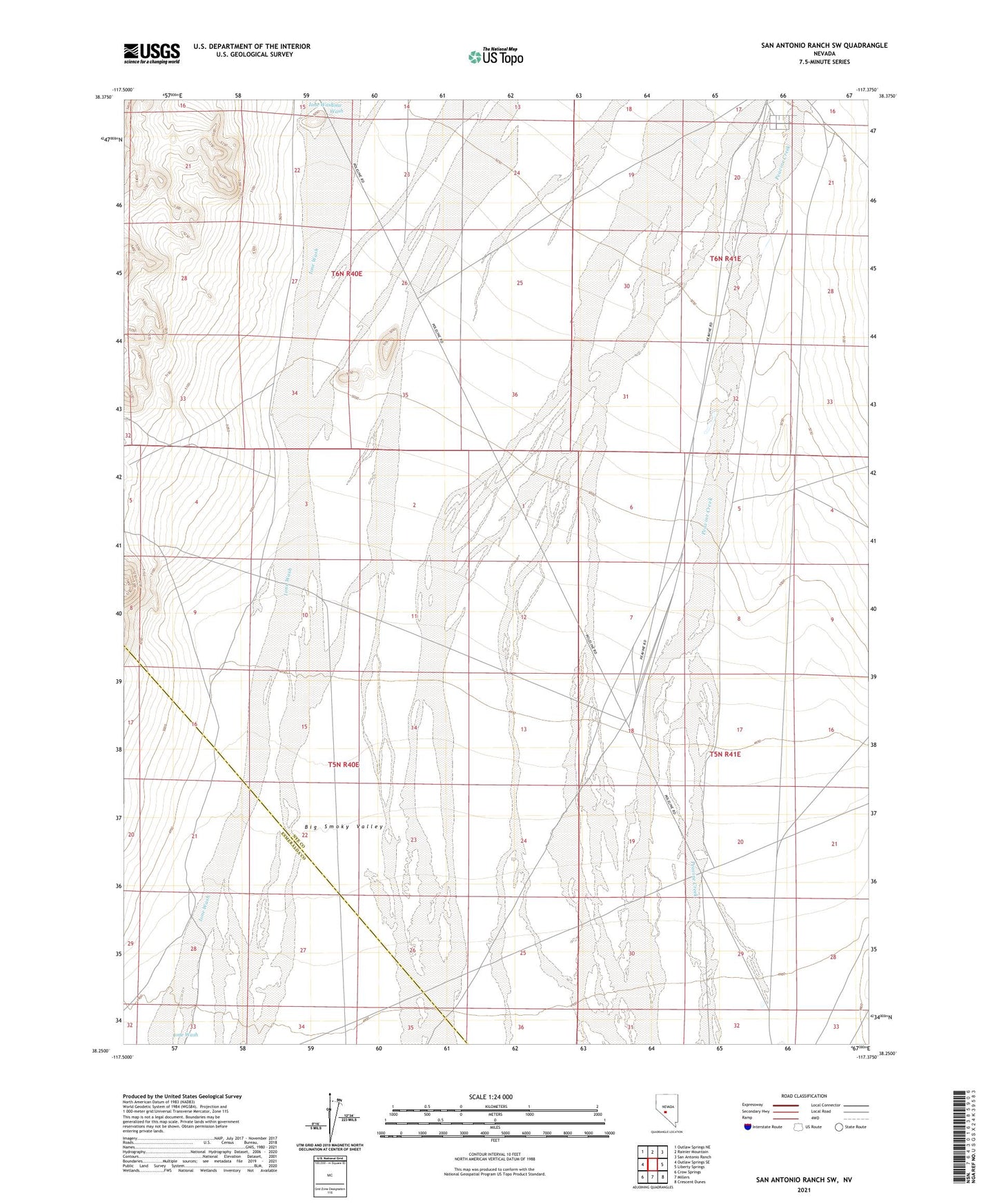
2021 topographic map quadrangle San Antonio Ranch SW in the state of Nevada. Scale: 1:24000. Based on the newly updated USGS 7.5' US Topo map series, this map is in the following counties: Nye, Esmeralda. The map contains contour data, water features, and other items you are used to seeing on USGS maps, but also has updated roads and other features. This is the next generation of topographic maps. Printed on high-quality waterproof paper with UV fade-resistant inks.
Quads adjacent to this one:
West: Outlaw Springs SE
Northwest: Outlaw Springs NE
North: Rainier Mountain
Northeast: San Antonio Ranch
East: Liberty Springs
Southeast: Crescent Dunes
South: Millers
Southwest: Crow Springs
This map covers the same area as the classic USGS quad with code o38117c4.
Contains the following named places: Bridge Well, Ione Wash, Midway Station