MyTopo
Sand Pass Nevada US Topo Map
Couldn't load pickup availability
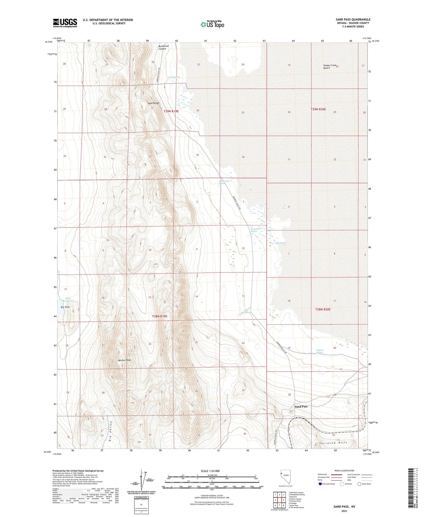
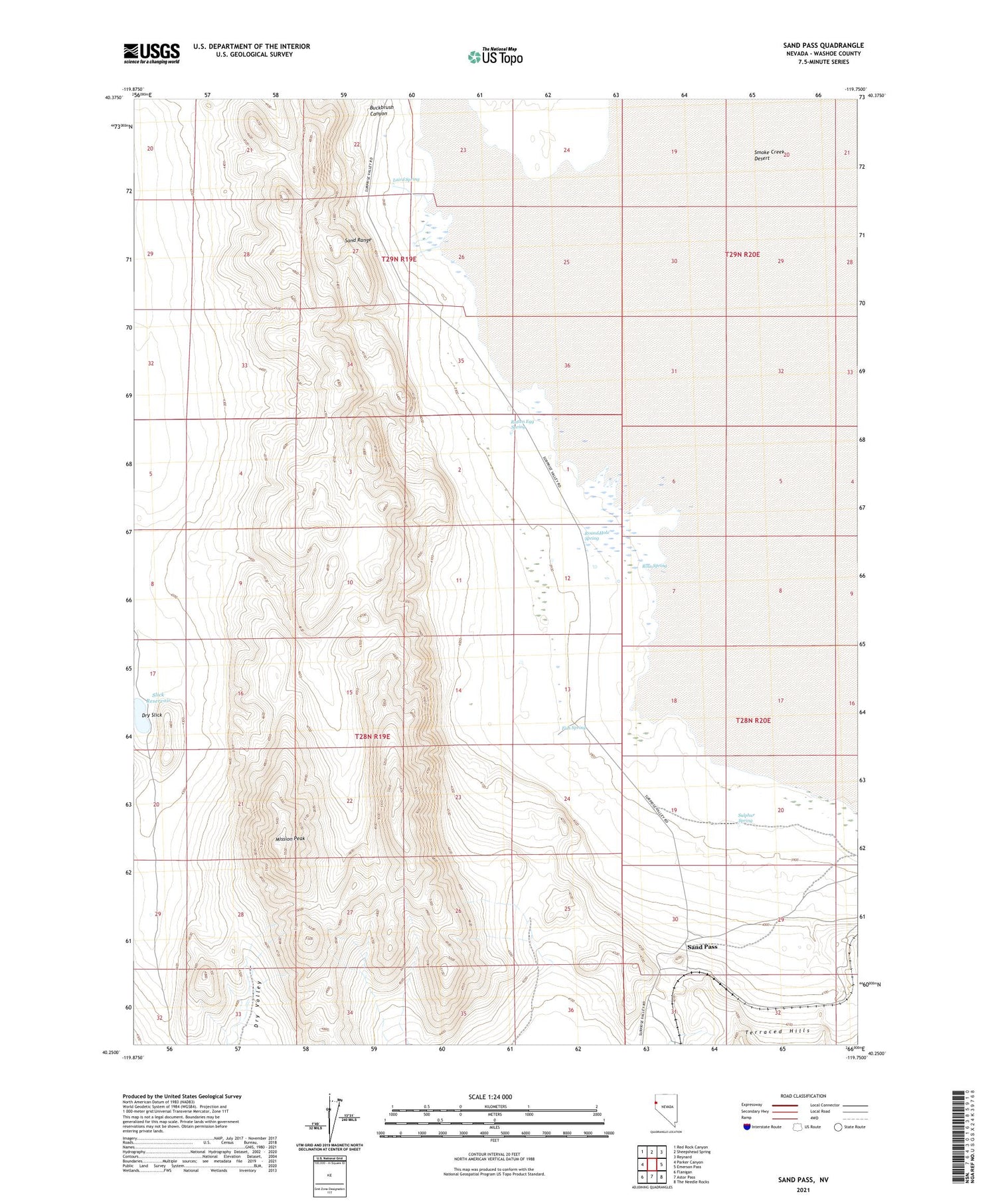
2021 topographic map quadrangle Sand Pass in the state of Nevada. Scale: 1:24000. Based on the newly updated USGS 7.5' US Topo map series, this map is in the following counties: Washoe. The map contains contour data, water features, and other items you are used to seeing on USGS maps, but also has updated roads and other features. This is the next generation of topographic maps. Printed on high-quality waterproof paper with UV fade-resistant inks.
Quads adjacent to this one:
West: Parker Canyon
Northwest: Red Rock Canyon
North: Sheepshead Spring
Northeast: Reynard
East: Emerson Pass
Southeast: The Needle Rocks
South: Astor Pass
Southwest: Flanigan
Contains the following named places: Bonham Ranch, Buckbrush Canyon, Dry Slick, Dry Valley Corrals, Fish Spring, Jack Bonham Ranch Well, Laird Spring, Mission Peak, Ross Spring, Rotten Egg Spring, Round Hole, Round Hole Spring, Roundhole, Sand Pass, Sand Pass Mining District, Sand Range, Sandpass Post Office, Slick Reservoir, Sulphur Spring