MyTopo
Astor Pass Nevada US Topo Map
Couldn't load pickup availability
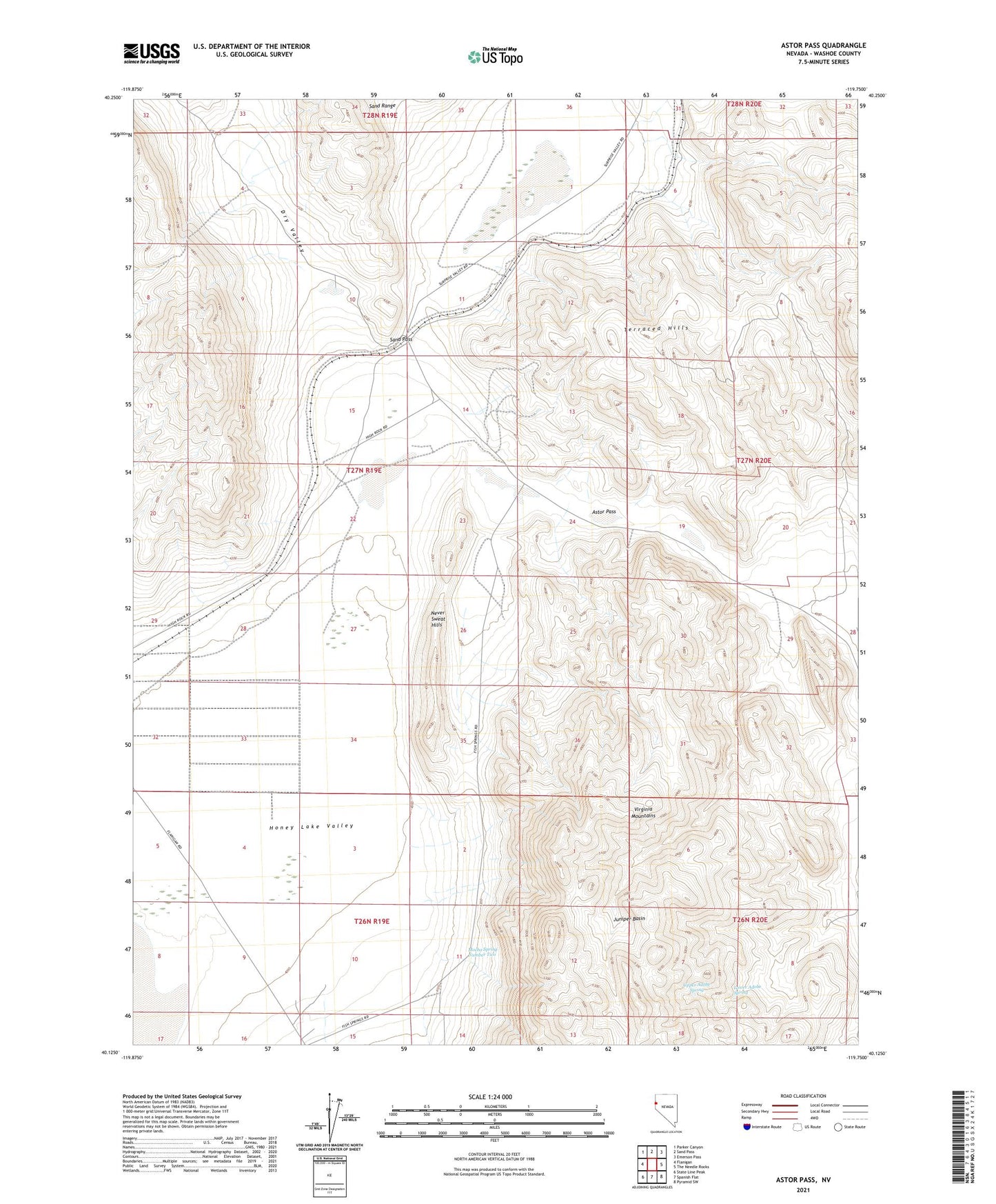
2021 topographic map quadrangle Astor Pass in the state of Nevada. Scale: 1:24000. Based on the newly updated USGS 7.5' US Topo map series, this map is in the following counties: Washoe. The map contains contour data, water features, and other items you are used to seeing on USGS maps, but also has updated roads and other features. This is the next generation of topographic maps. Printed on high-quality waterproof paper with UV fade-resistant inks.
Quads adjacent to this one:
West: Flanigan
Northwest: Parker Canyon
North: Sand Pass
Northeast: Emerson Pass
East: The Needle Rocks
Southeast: Pyramid SW
South: Spanish Flat
Southwest: State Line Peak
This map covers the same area as the classic USGS quad with code o40119b7.
Contains the following named places: Astor, Astor Pass, Bonham Well, Cottonwood Creek, Double Check, Double Check Well, Dry Valley, Flanigan Mining District, Fred True Well, Honey Lake Valley, Junction City, Juniper Basin, Kepler, Lower Adobe Spring, Mission Peak Well, Mocho Spring Number Two, Never Sweat Hills, Sand Pass, Upper Adobe Spring