MyTopo
The Needle Rocks Nevada US Topo Map
Couldn't load pickup availability
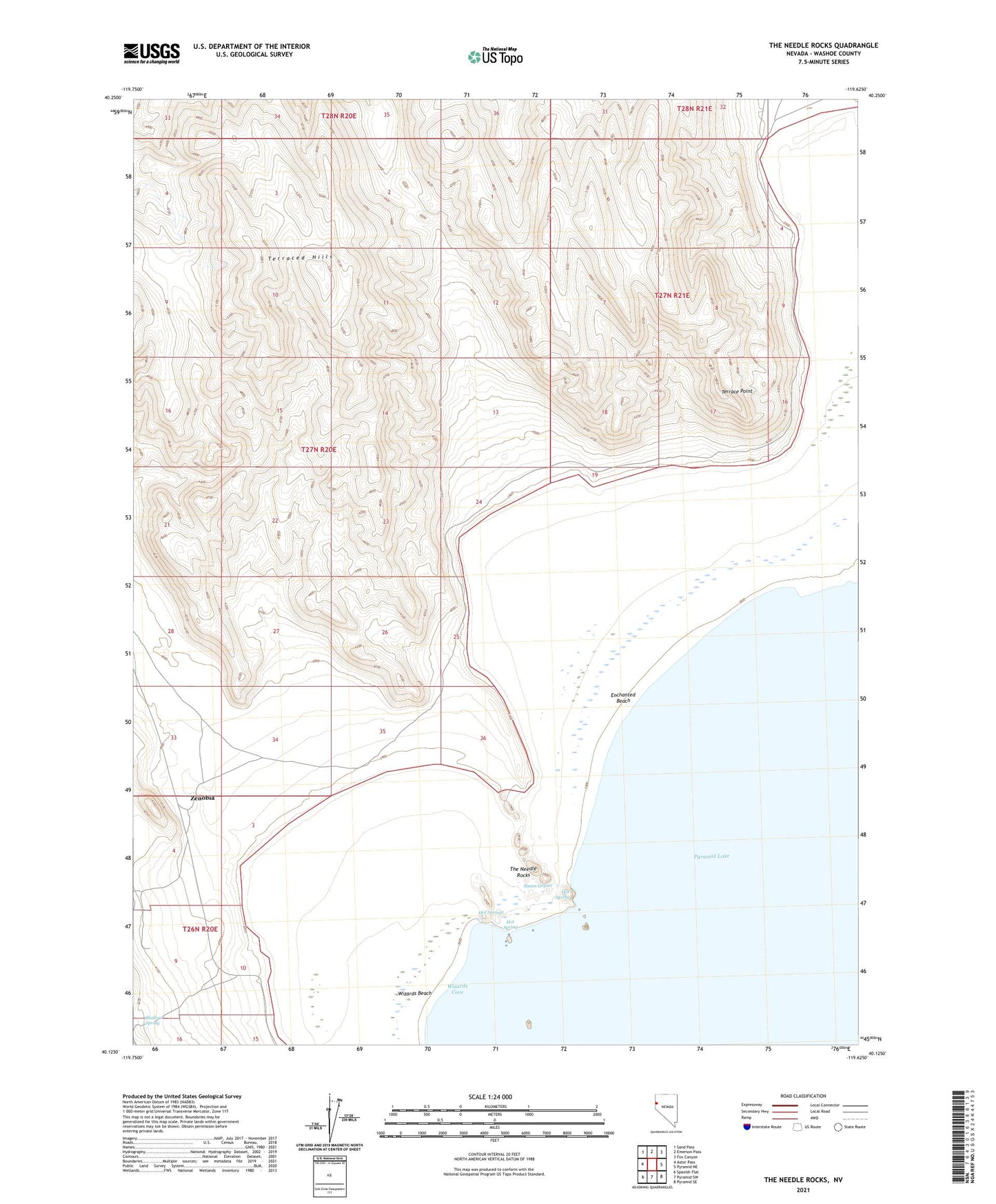
2021 topographic map quadrangle The Needle Rocks in the state of Nevada. Scale: 1:24000. Based on the newly updated USGS 7.5' US Topo map series, this map is in the following counties: Washoe. The map contains contour data, water features, and other items you are used to seeing on USGS maps, but also has updated roads and other features. This is the next generation of topographic maps. Printed on high-quality waterproof paper with UV fade-resistant inks.
Quads adjacent to this one:
West: Astor Pass
Northwest: Sand Pass
North: Emerson Pass
Northeast: Fox Canyon
East: Pyramid NE
Southeast: Pyramid SE
South: Pyramid SW
Southwest: Spanish Flat
This map covers the same area as the classic USGS quad with code o40119b6.
Contains the following named places: Enchanted Beach, Hot Spring, Hot Springs, Shallow Spring, Steam Geyser, Terrace Point, Terraced Hills, The Needle Rocks, Zenobia