MyTopo
Sloan Nevada US Topo Map
Couldn't load pickup availability
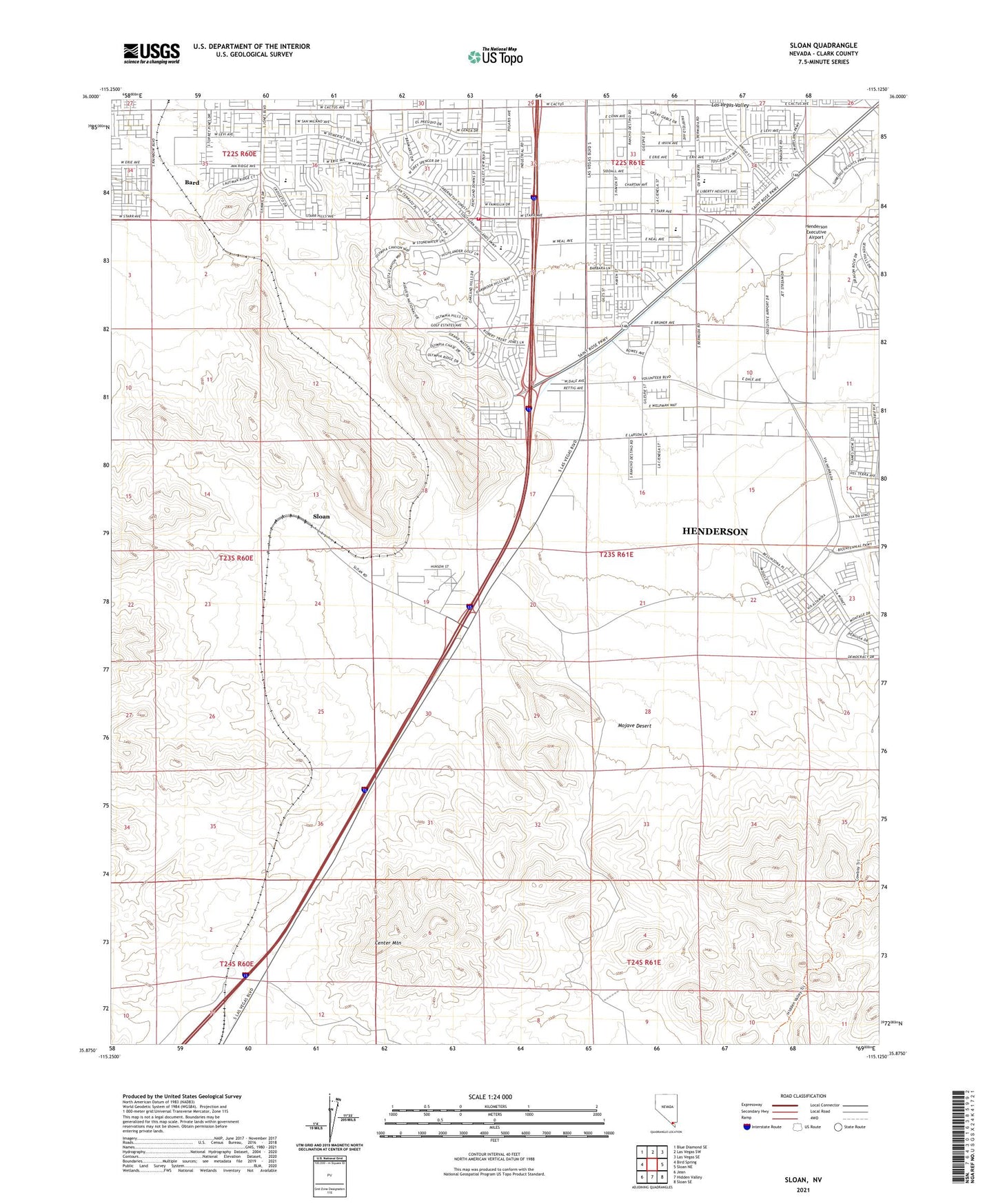
2021 topographic map quadrangle Sloan in the state of Nevada. Scale: 1:24000. Based on the newly updated USGS 7.5' US Topo map series, this map is in the following counties: Clark. The map contains contour data, water features, and other items you are used to seeing on USGS maps, but also has updated roads and other features. This is the next generation of topographic maps. Printed on high-quality waterproof paper with UV fade-resistant inks.
Quads adjacent to this one:
West: Bird Spring
Northwest: Blue Diamond SE
North: Las Vegas SW
Northeast: Las Vegas SE
East: Sloan NE
Southeast: Sloan SE
South: Hidden Valley
Southwest: Jean
This map covers the same area as the classic USGS quad with code o35115h2.
Contains the following named places: Bard, Bard Mining District, Center Mountain, Charles and Phyllis Frias Elementary School, Clark County Fire Department Station 65, Henderson Executive Airport, Liberty High School, Life Guard International, Mercy Air Services 7, Oasis Christian Church, Sloan, Sloan Limestone Quarry, Sloan Mining District, Sloan Post Office, Southern Highlands Preparatory School, Steve Schorr Elementary School, ZIP Codes: 89044, 89054, 89141, 89183