MyTopo
Jean Nevada US Topo Map
Couldn't load pickup availability
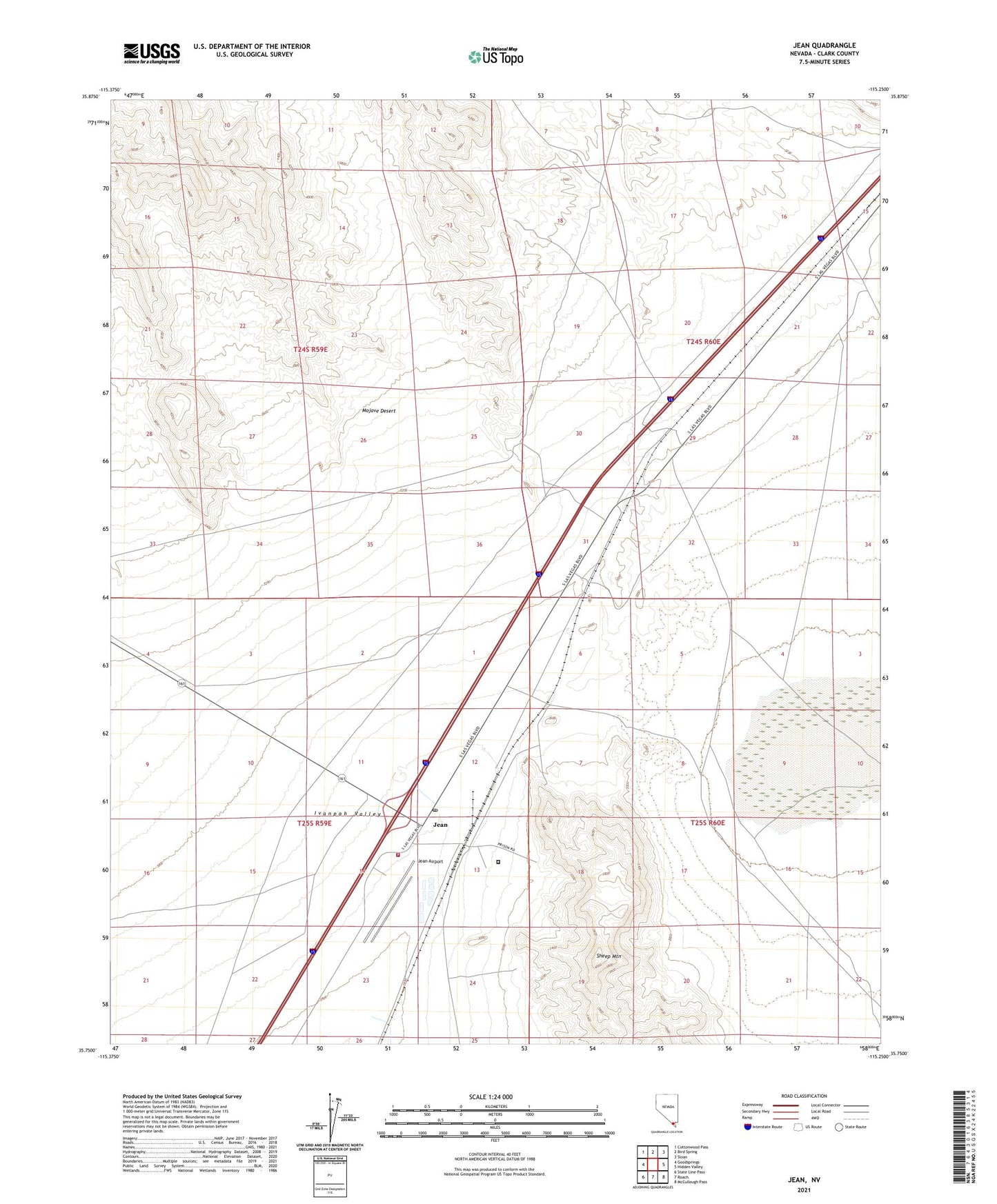
2021 topographic map quadrangle Jean in the state of Nevada. Scale: 1:24000. Based on the newly updated USGS 7.5' US Topo map series, this map is in the following counties: Clark. The map contains contour data, water features, and other items you are used to seeing on USGS maps, but also has updated roads and other features. This is the next generation of topographic maps. Printed on high-quality waterproof paper with UV fade-resistant inks.
Quads adjacent to this one:
West: Goodsprings
Northwest: Cottonwood Pass
North: Bird Spring
Northeast: Sloan
East: Hidden Valley
Southeast: McCullough Pass
South: Roach
Southwest: State Line Pass
This map covers the same area as the classic USGS quad with code o35115g3.
Contains the following named places: Clark County Fire Department Station 87, Goodsprings Township, Ivanpah Valley, Jean, Jean Airport, Jean Lake, Jean Post Office, Jean Station, Nevada Highway Patrol Southern Command Jean Substation, Nevada State Prison, Sandy Valley Elementary School, Sheep Mountain, Sutor, Sutor Mining District, ZIP Code: 89026