MyTopo
South of Amargosa Valley Nevada US Topo Map
Couldn't load pickup availability
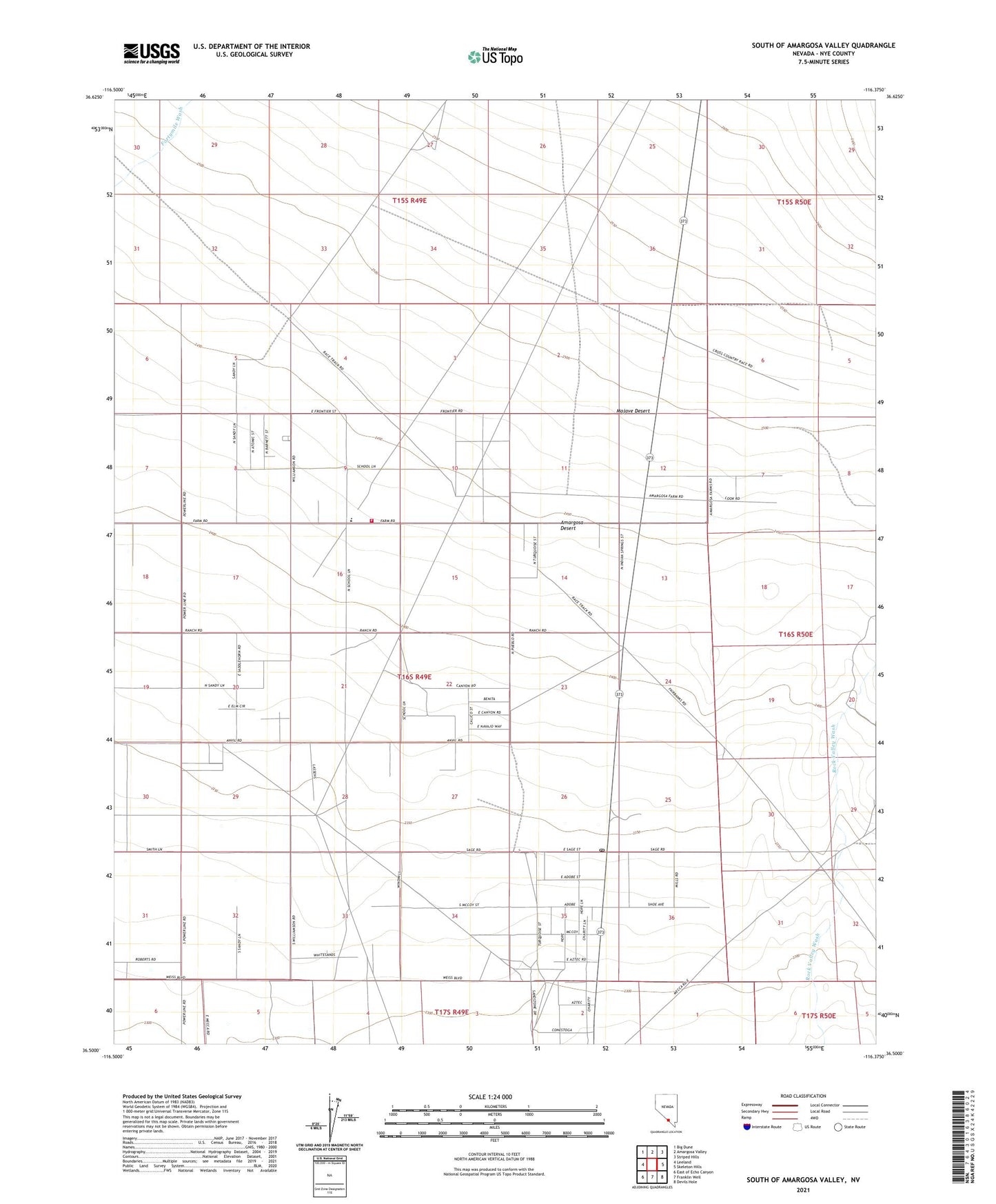
2021 topographic map quadrangle South of Amargosa Valley in the state of Nevada. Scale: 1:24000. Based on the newly updated USGS 7.5' US Topo map series, this map is in the following counties: Nye. The map contains contour data, water features, and other items you are used to seeing on USGS maps, but also has updated roads and other features. This is the next generation of topographic maps. Printed on high-quality waterproof paper with UV fade-resistant inks.
Quads adjacent to this one:
West: Leeland
Northwest: Big Dune
East: Skeleton Hills
Southeast: Devils Hole
South: Franklin Well
Southwest: East of Echo Canyon
This map covers the same area as the classic USGS quad with code o36116e4.
Contains the following named places: Amargosa Valley Census Designated Place, Amargosa Valley Division, Amargosa Valley Fire Department, Amargosa Volunteer Ambulance Service, Millers Well Number One, Nye County Sheriff's Office, ZIP Code: 89020