MyTopo
Spanish Springs Peak Nevada US Topo Map
Couldn't load pickup availability
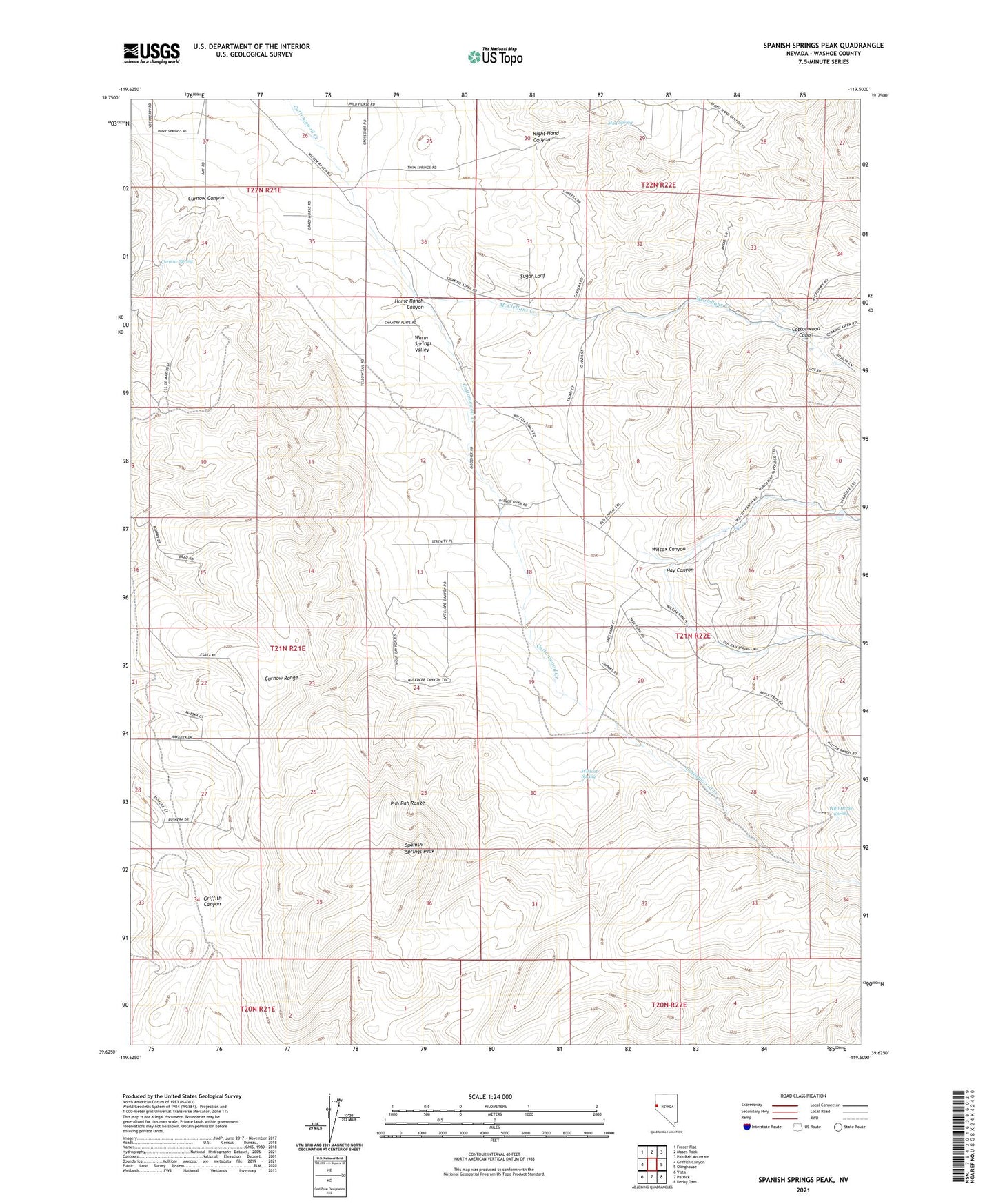
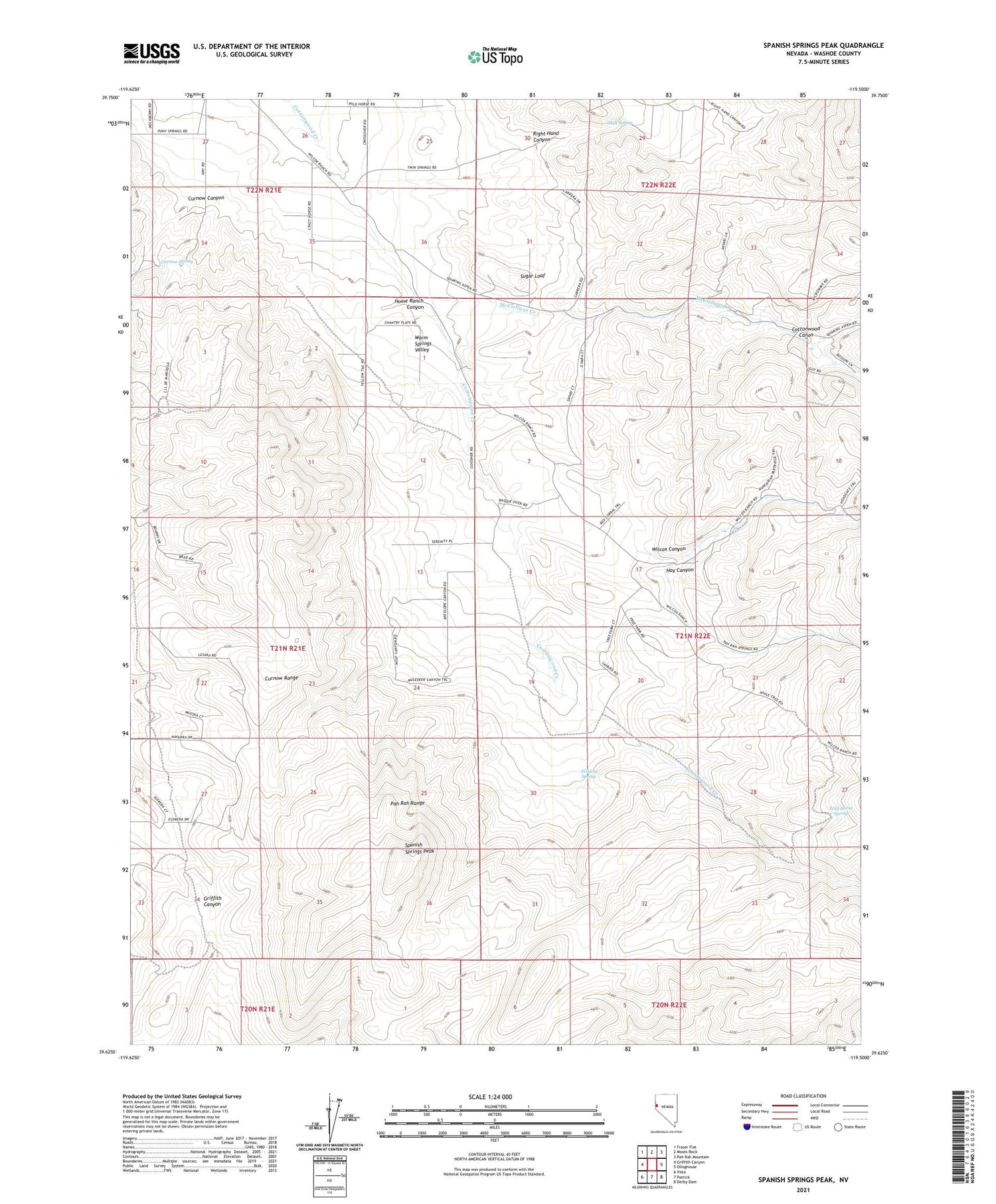
2021 topographic map quadrangle Spanish Springs Peak in the state of Nevada. Scale: 1:24000. Based on the newly updated USGS 7.5' US Topo map series, this map is in the following counties: Washoe. The map contains contour data, water features, and other items you are used to seeing on USGS maps, but also has updated roads and other features. This is the next generation of topographic maps. Printed on high-quality waterproof paper with UV fade-resistant inks.
Quads adjacent to this one:
West: Griffith Canyon
Northwest: Fraser Flat
North: Moses Rock
Northeast: Pah Rah Mountain
East: Olinghouse
Southeast: Derby Dam
South: Patrick
Southwest: Vista
Contains the following named places: Cottonwood Canon, Curnow Canyon, Curnow Spring, Donatelli Mine, Hay Canyon, Home Ranch Canyon, McClellans Creek, Mud Spring, Right Hand Canyon, Sleepy Joe Mine, Spanish Springs Peak, Sugar Loaf, Warm Springs-Truckee Canyon Division, Wilcox Canyon, Wilcox Ranch, Wild Horse Spring, Wildcat Spring, Wofford Airport