MyTopo
Teels Marsh Nevada US Topo Map
Couldn't load pickup availability
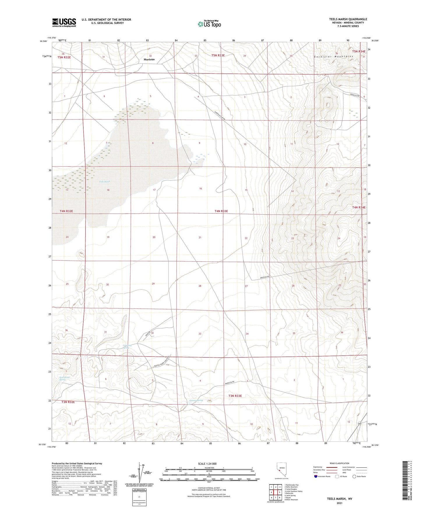
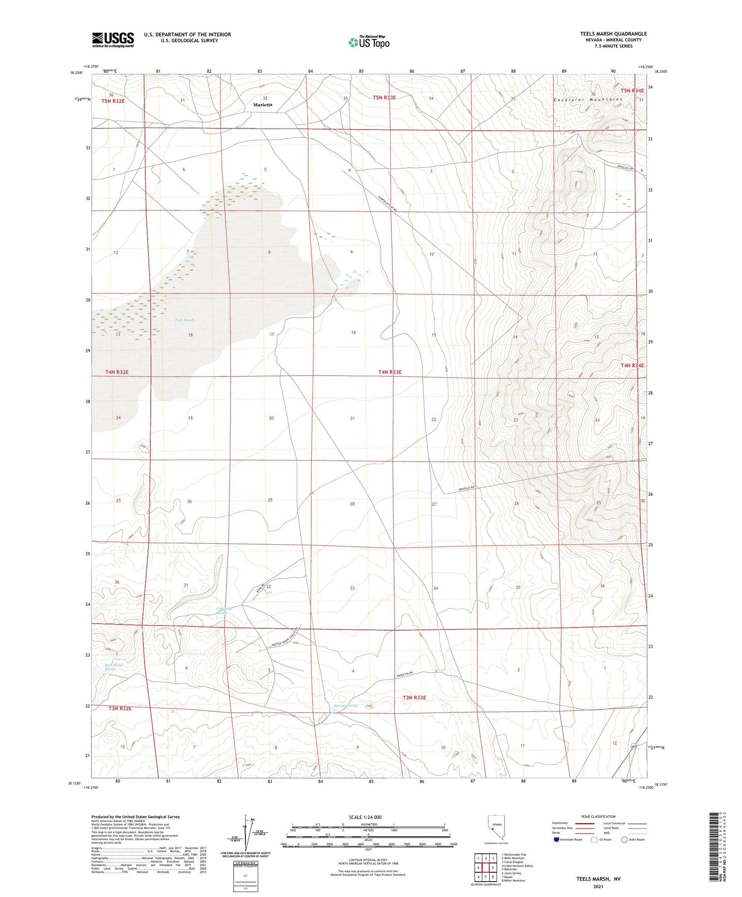
2021 topographic map quadrangle Teels Marsh in the state of Nevada. Scale: 1:24000. Based on the newly updated USGS 7.5' US Topo map series, this map is in the following counties: Mineral. The map contains contour data, water features, and other items you are used to seeing on USGS maps, but also has updated roads and other features. This is the next generation of topographic maps. Printed on high-quality waterproof paper with UV fade-resistant inks.
Quads adjacent to this one:
West: Little Huntoon Valley
Northwest: Rattlesnake Flat
North: Moho Mountain
Northeast: Camp Douglas
East: Belleville
Southeast: Miller Mountain
South: Basalt
Southwest: Jacks Spring
Contains the following named places: Company Spring, Endowment Mill, German Spring, London Silver Lead Mines Company Mill, Marietta, Marietta Post Office, Rock House Spring, Rutty Mill, Smith Borax Reduction Works, Teels Marsh, Teels Marsh Mining District