MyTopo
Miller Mountain Nevada US Topo Map
Couldn't load pickup availability
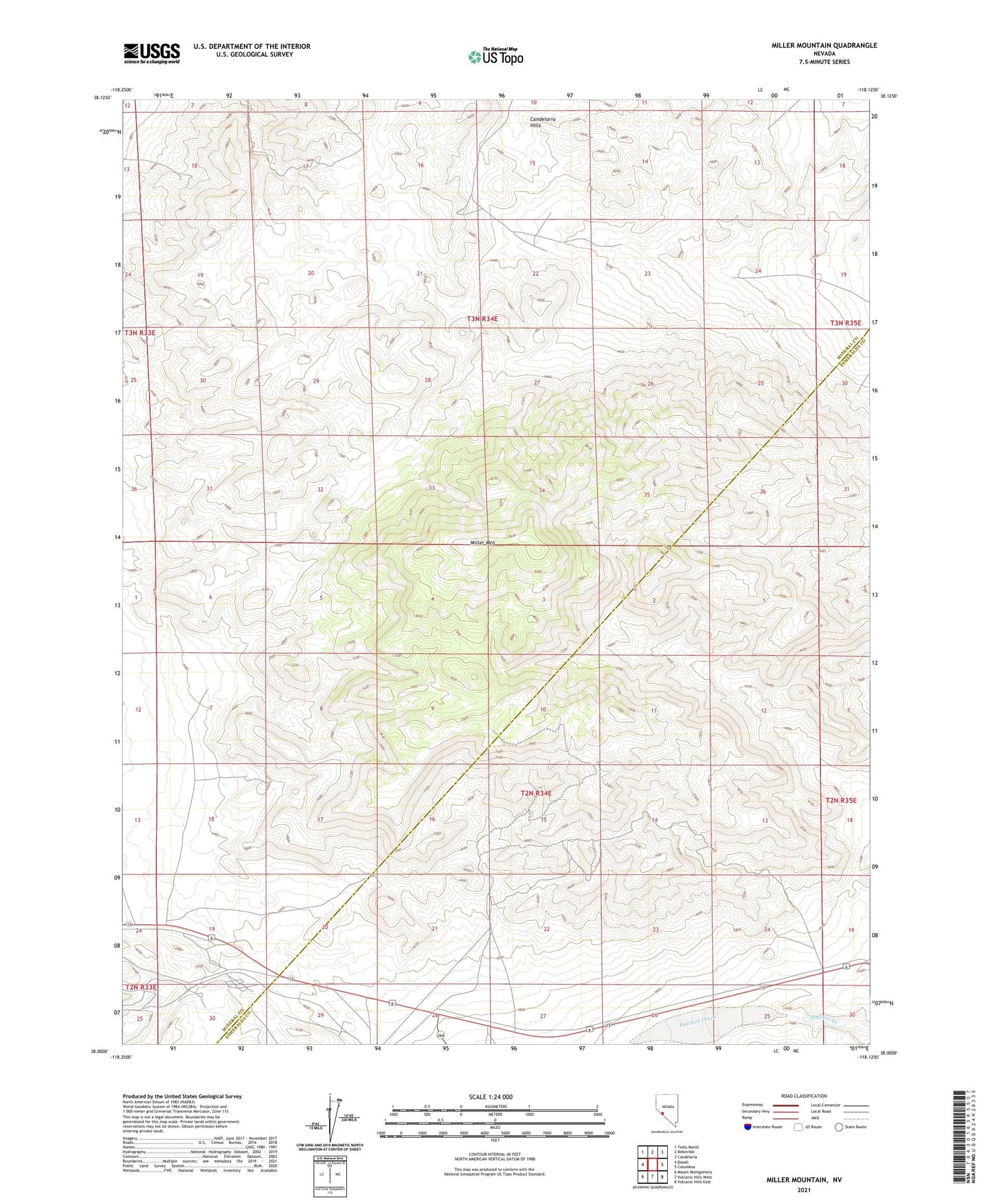
2021 topographic map quadrangle Miller Mountain in the state of Nevada. Scale: 1:24000. Based on the newly updated USGS 7.5' US Topo map series, this map is in the following counties: Mineral, Esmeralda. The map contains contour data, water features, and other items you are used to seeing on USGS maps, but also has updated roads and other features. This is the next generation of topographic maps. Printed on high-quality waterproof paper with UV fade-resistant inks.
Quads adjacent to this one:
West: Basalt
Northwest: Teels Marsh
North: Belleville
Northeast: Candelaria
East: Columbus
Southeast: Volcanic Hills East
South: Volcanic Hills West
Southwest: Mount Montgomery
This map covers the same area as the classic USGS quad with code o38118a2.
Contains the following named places: Black Horse Mine, Black Horse Mining District, Dicalite Mine, Kelly and Clark Mine, Maxfield Mine, Miller Mountain, Sorenson Construction Mine