MyTopo
Tempiute Mountain South Nevada US Topo Map
Couldn't load pickup availability
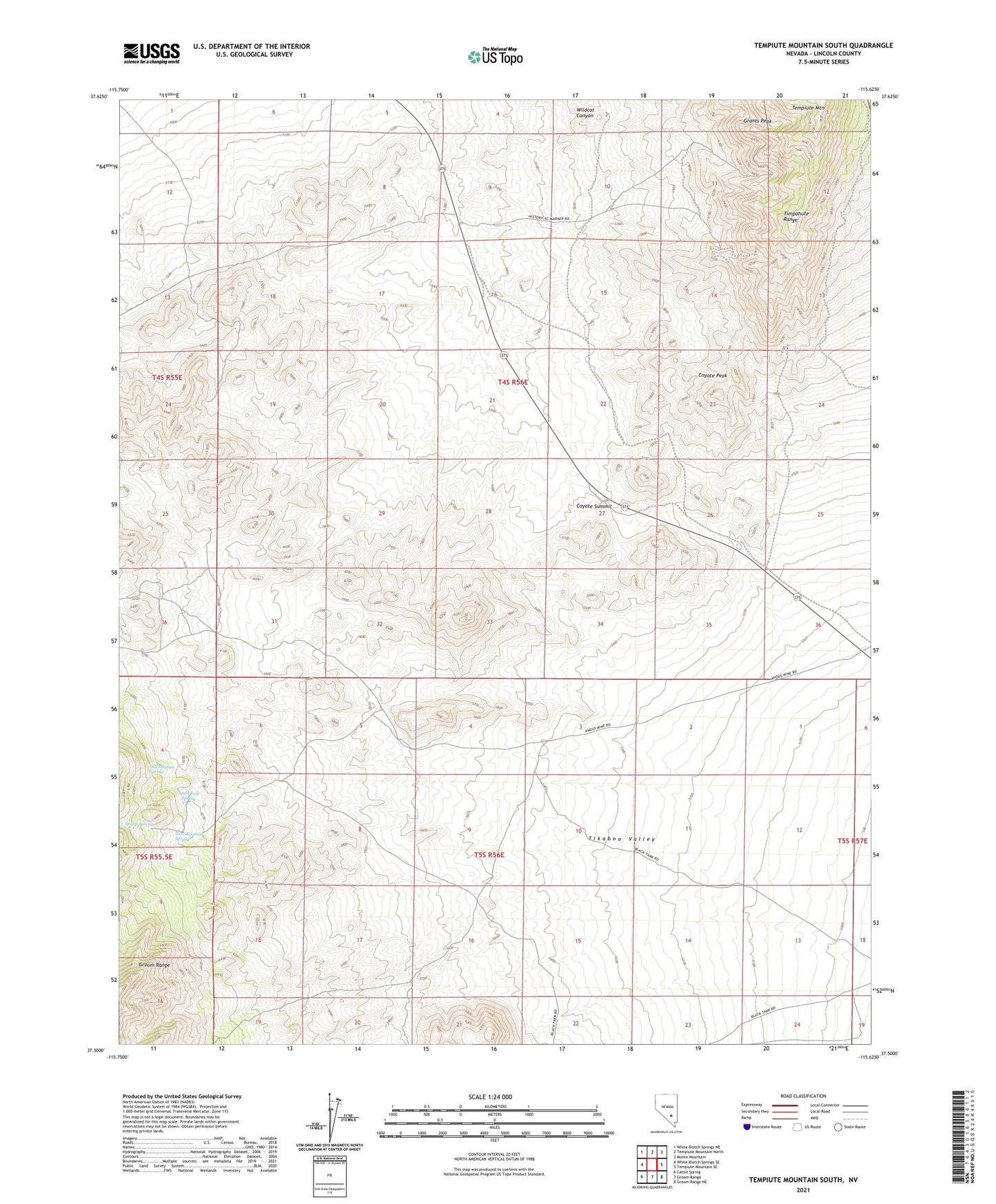
2021 topographic map quadrangle Tempiute Mountain South in the state of Nevada. Scale: 1:24000. Based on the newly updated USGS 7.5' US Topo map series, this map is in the following counties: Lincoln. The map contains contour data, water features, and other items you are used to seeing on USGS maps, but also has updated roads and other features. This is the next generation of topographic maps. Printed on high-quality waterproof paper with UV fade-resistant inks.
Quads adjacent to this one:
West: White Blotch Springs SE
Northwest: White Blotch Springs NE
North: Tempiute Mountain North
Northeast: Monte Mountain
East: Tempiute Mountain SE
Southeast: Groom Range NE
This map covers the same area as the classic USGS quad with code o37115e6.
Contains the following named places: Andies Mine, April Fool Spring, Charco Pit Reservoir, Coyote Peak, Coyote Summit, Don Dale Mine, Don Dale Mining District, Grants Peak, New Tikaboo Spring, Old Tem Piute Mine, Old Tikaboo Spring, Sharp Spring, Tempiute Historic Site, Tempiute Mountain, Wildcat Canyon