MyTopo
The Gouge Eye Nevada US Topo Map
Couldn't load pickup availability
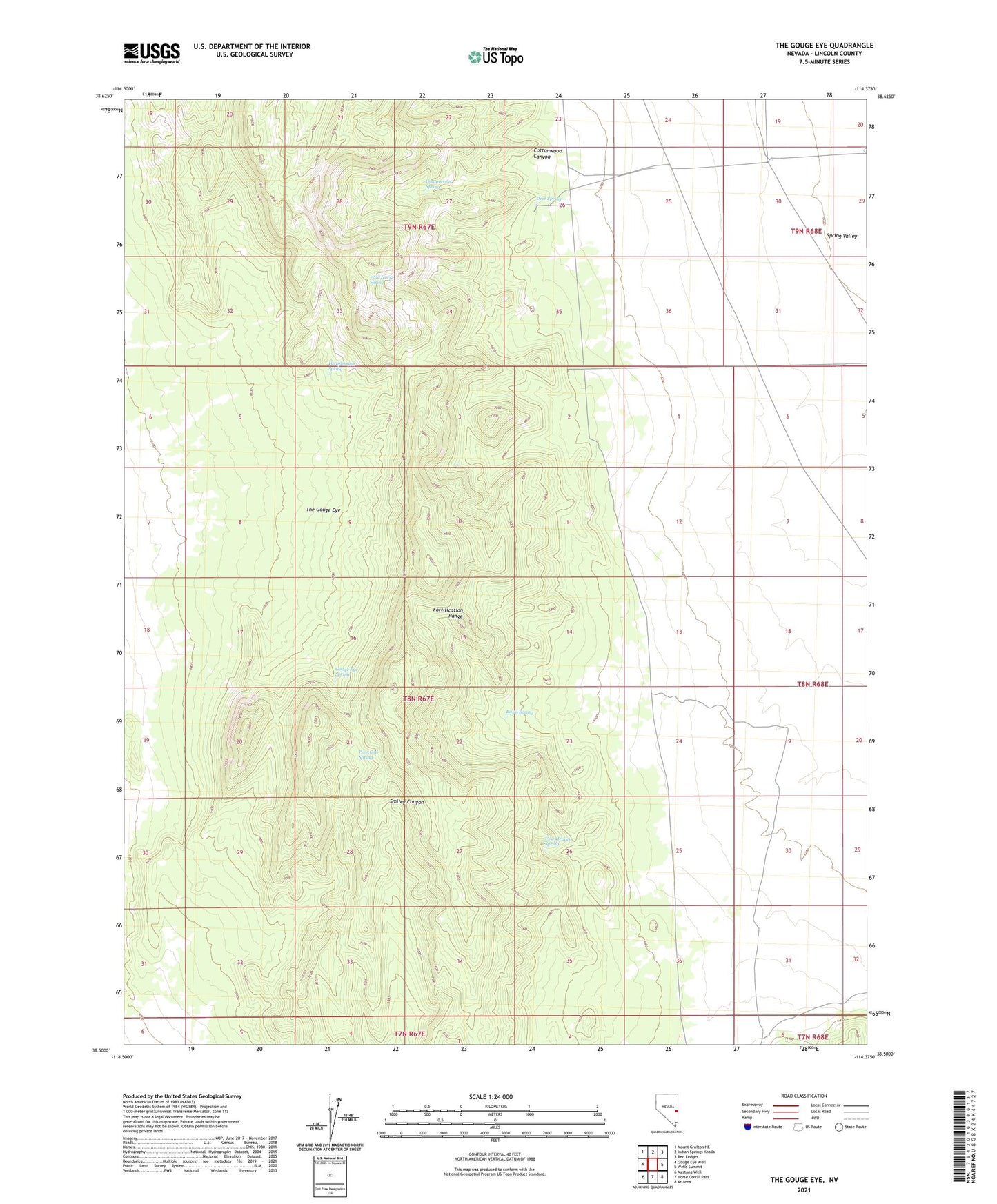
2021 topographic map quadrangle The Gouge Eye in the state of Nevada. Scale: 1:24000. Based on the newly updated USGS 7.5' US Topo map series, this map is in the following counties: Lincoln. The map contains contour data, water features, and other items you are used to seeing on USGS maps, but also has updated roads and other features. This is the next generation of topographic maps. Printed on high-quality waterproof paper with UV fade-resistant inks.
Quads adjacent to this one:
West: Gouge Eye Well
Northwest: Mount Grafton NE
North: Indian Springs Knolls
Northeast: Red Ledges
East: Wells Summit
Southeast: Atlanta
South: Horse Corral Pass
Southwest: Mustang Well
This map covers the same area as the classic USGS quad with code o38114e4.
Contains the following named places: Basin Spring, Cottonwood Canyon, Cottonwood Spring, Cow Heaven Spring, Deer Spring, Fortification Range, Fortification Range Wilderness, Fortification Spring, Gouge Eye Spring, Poor Cow Spring, The Gouge Eye, Wild Horse Spring