MyTopo
Atlanta Nevada US Topo Map
Couldn't load pickup availability
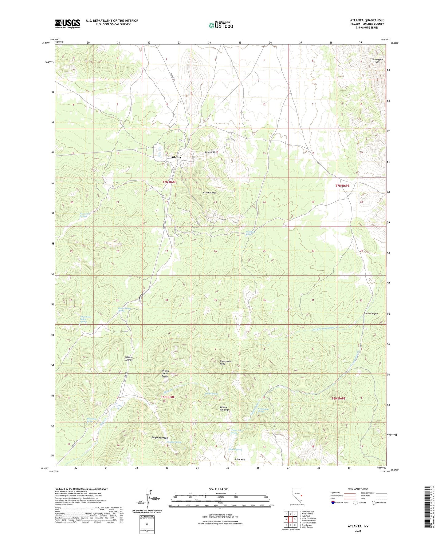
2021 topographic map quadrangle Atlanta in the state of Nevada. Scale: 1:24000. Based on the newly updated USGS 7.5' US Topo map series, this map is in the following counties: Lincoln. The map contains contour data, water features, and other items you are used to seeing on USGS maps, but also has updated roads and other features. This is the next generation of topographic maps. Printed on high-quality waterproof paper with UV fade-resistant inks.
Quads adjacent to this one:
West: Horse Corral Pass
Northwest: The Gouge Eye
North: Wells Summit
Northeast: Hyde Well
East: Rosencrans Knolls
Southeast: Miller Canyon
South: Trail Canyon
Southwest: Schoolmarm Basin
This map covers the same area as the classic USGS quad with code o38114d3.
Contains the following named places: Atlanta, Atlanta Mine, Atlanta Mining District, Atlanta Peak, Atlanta Post Office, Atlanta Summit, Basket Spring, Bradshaw Mine, Bradshaw Spring, Brown Water Spring, Democracy Mine, Easter Mine, Empy Meadows, Hulse Mine, Lizard Spring, Meadow Spring, Mineral Hill, Moonshine Spring, Rosencrans Peak, Rosencrans Spring, Silver Park, Silver Park Mine, Silver Park Springs, Smith Canyon, Solo Joker Mine, West Fork Rosencrans Creek, White Rock-Bailey Springs, Willow Tub Peak, Willow Tub Spring, Wilson Creek