MyTopo
Toe Jam Mountain Nevada US Topo Map
Couldn't load pickup availability
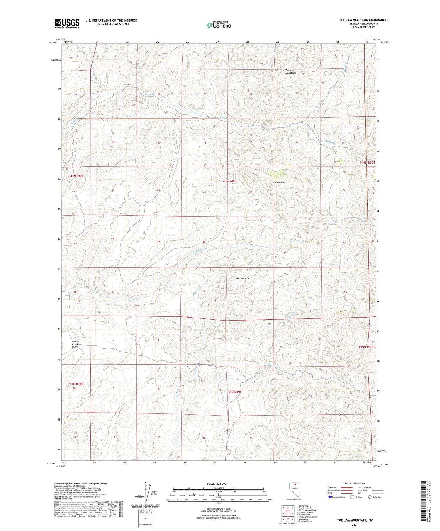
2021 topographic map quadrangle Toe Jam Mountain in the state of Nevada. Scale: 1:24000. Based on the newly updated USGS 7.5' US Topo map series, this map is in the following counties: Elko. The map contains contour data, water features, and other items you are used to seeing on USGS maps, but also has updated roads and other features. This is the next generation of topographic maps. Printed on high-quality waterproof paper with UV fade-resistant inks.
Quads adjacent to this one:
West: Little Rock Creek
Northwest: Soldier Cap
North: Red Cow Creek
Northeast: Big Cottonwood Canyon
East: Mount Blitzen
Southeast: Sugarloaf Butte
South: China Camp
Southwest: Willow Creek Reservoir
This map covers the same area as the classic USGS quad with code o41116c4.
Contains the following named places: Dry Creek, Ellison Ranch, Falcon Mines, Falcon Post Office, Lewis Creek, Nelson Field, Pole Creek, Rock Creek, Rock Creek Mining District, Scorpion Works, Toe Jam Mountain, Walker Mountain, Willow Creek