MyTopo
Tuscarora Nevada US Topo Map
Couldn't load pickup availability
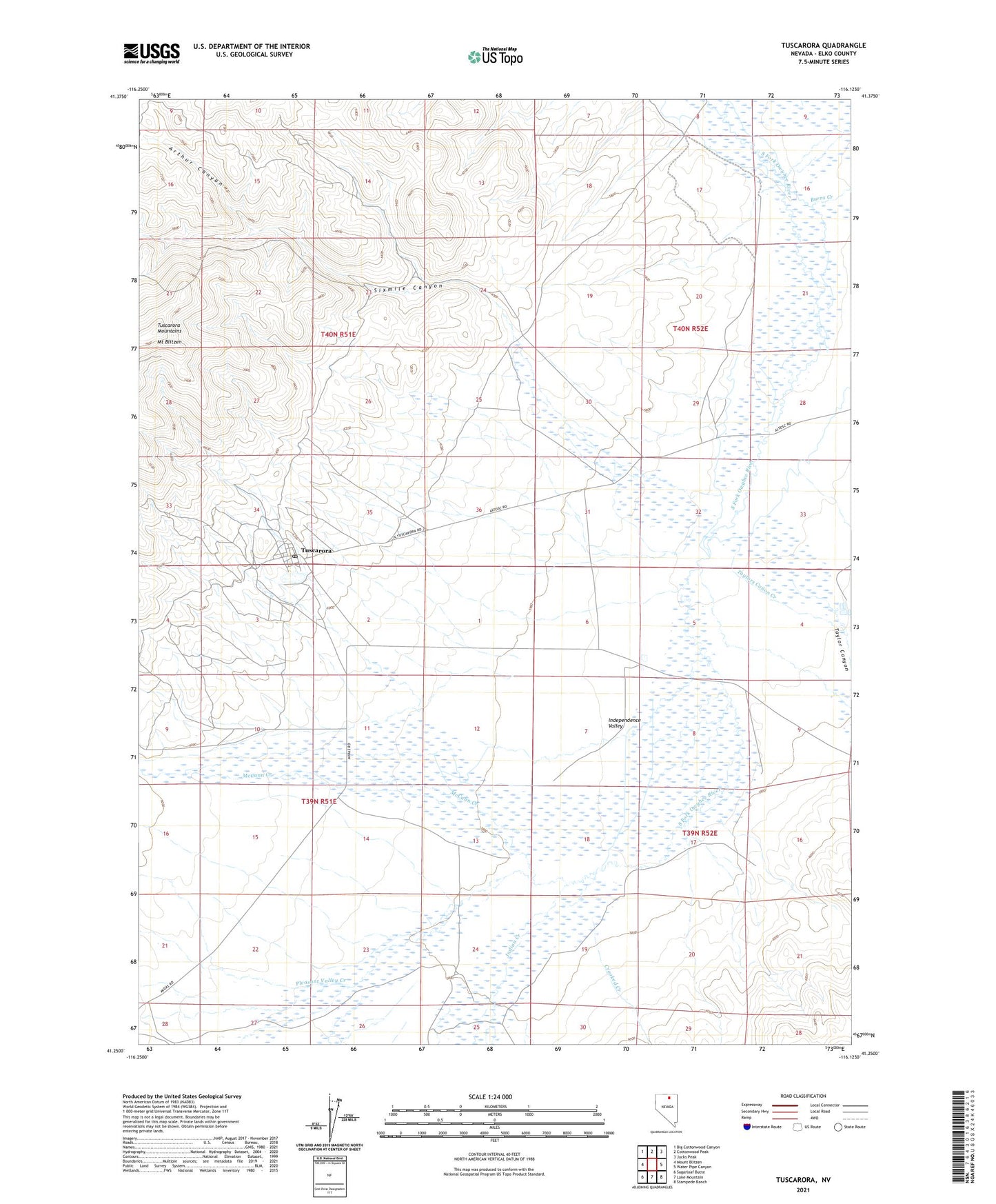
2021 topographic map quadrangle Tuscarora in the state of Nevada. Scale: 1:24000. Based on the newly updated USGS 7.5' US Topo map series, this map is in the following counties: Elko. The map contains contour data, water features, and other items you are used to seeing on USGS maps, but also has updated roads and other features. This is the next generation of topographic maps. Printed on high-quality waterproof paper with UV fade-resistant inks.
Quads adjacent to this one:
West: Mount Blitzen
Northwest: Big Cottonwood Canyon
North: Cottonwood Peak
Northeast: Jacks Peak
East: Water Pipe Canyon
Southeast: Stampede Ranch
South: Lake Mountain
Southwest: Sugarloaf Butte
This map covers the same area as the classic USGS quad with code o41116c2.
Contains the following named places: Adams Creek, Argenta Mine, Arthur Canyon, Badger Creek, Belle Isle Mine, Boulder Creek, Burns Creek, Commonwealth Mine, Crooked Creek, De Freez Mine, Dexter Mill, Dexter Mine, Eira Mine, Fort Tuscarora, Gold Bug Mine, Grand Prize Mine, Independence Valley Elementary School, Indian Creek, McCann Creek, Modoc Mine, Navajo Mine, North Belle Isle Mine, North Commonwealth Mine, Old Tuscarora, Pleasant Valley Creek, Quarter Circle S Ranch, Queen Mine, Sixmile Canyon, Taylor Canyon, Taylors Canon Creek, Tuscarora, Tuscarora Mining District, Tuscarora Post Office