MyTopo
Virgin Valley Nevada US Topo Map
Couldn't load pickup availability
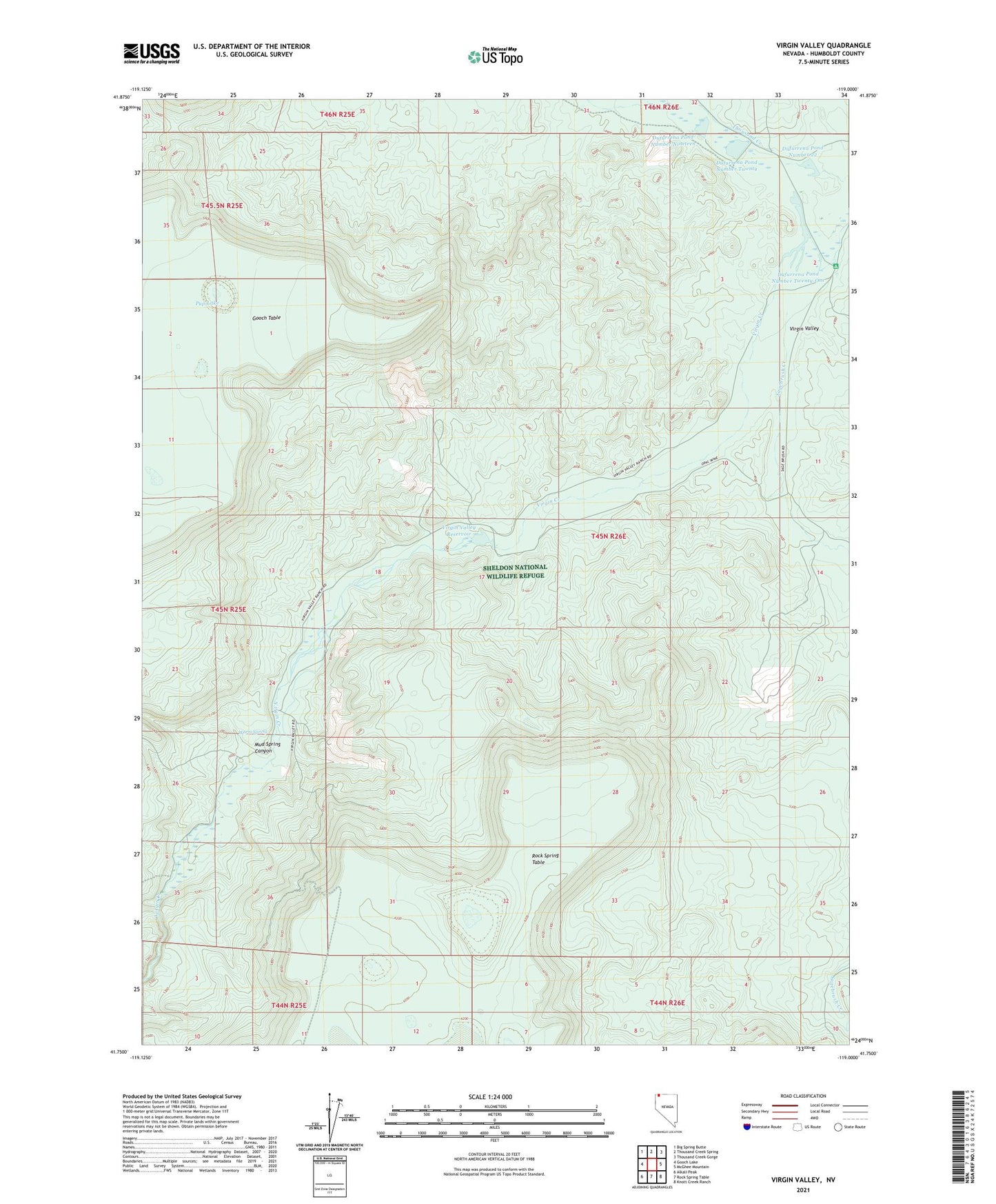
2021 topographic map quadrangle Virgin Valley in the state of Nevada. Scale: 1:24000. Based on the newly updated USGS 7.5' US Topo map series, this map is in the following counties: Humboldt. The map contains contour data, water features, and other items you are used to seeing on USGS maps, but also has updated roads and other features. This is the next generation of topographic maps. Printed on high-quality waterproof paper with UV fade-resistant inks.
Quads adjacent to this one:
West: Gooch Lake
Northwest: Big Spring Butte
North: Thousand Creek Spring
Northeast: Thousand Creek Gorge
East: McGhee Mountain
Southeast: Knott Creek Ranch
South: Rock Spring Table
Southwest: Alkali Peak
This map covers the same area as the classic USGS quad with code o41119g1.
Contains the following named places: Big Spring Creek, Dam Number 10 Dam, Dufurrena Pond Number 19 Dam, Dufurrena Pond Number 20 Dam, Dufurrena Pond Number 22, Dufurrena Pond Number Nineteen, Dufurrena Pond Number Twenty, Dufurrena Pond Number Twenty-One, Dufurrena Ranch, Dufurrena Ranch Headquarters, Esling Ranch, Mud Spring Canyon, Pond Number Thirteen, Pup Lake, Rainbow Ridge Mine, Royal Peacock Mine, Sagebrush Creek, Virgin Mine, Virgin Valley, Virgin Valley Campground, Virgin Valley Mining District, Virgin Valley Ranch, Virgin Valley Reservoir, Virgin Valley Reservoir Dam, Warm Spring