MyTopo
Wadsworth Ranch Nevada US Topo Map
Couldn't load pickup availability
Also explore the Wadsworth Ranch Forest Service Topo of this same quad for updated USFS data
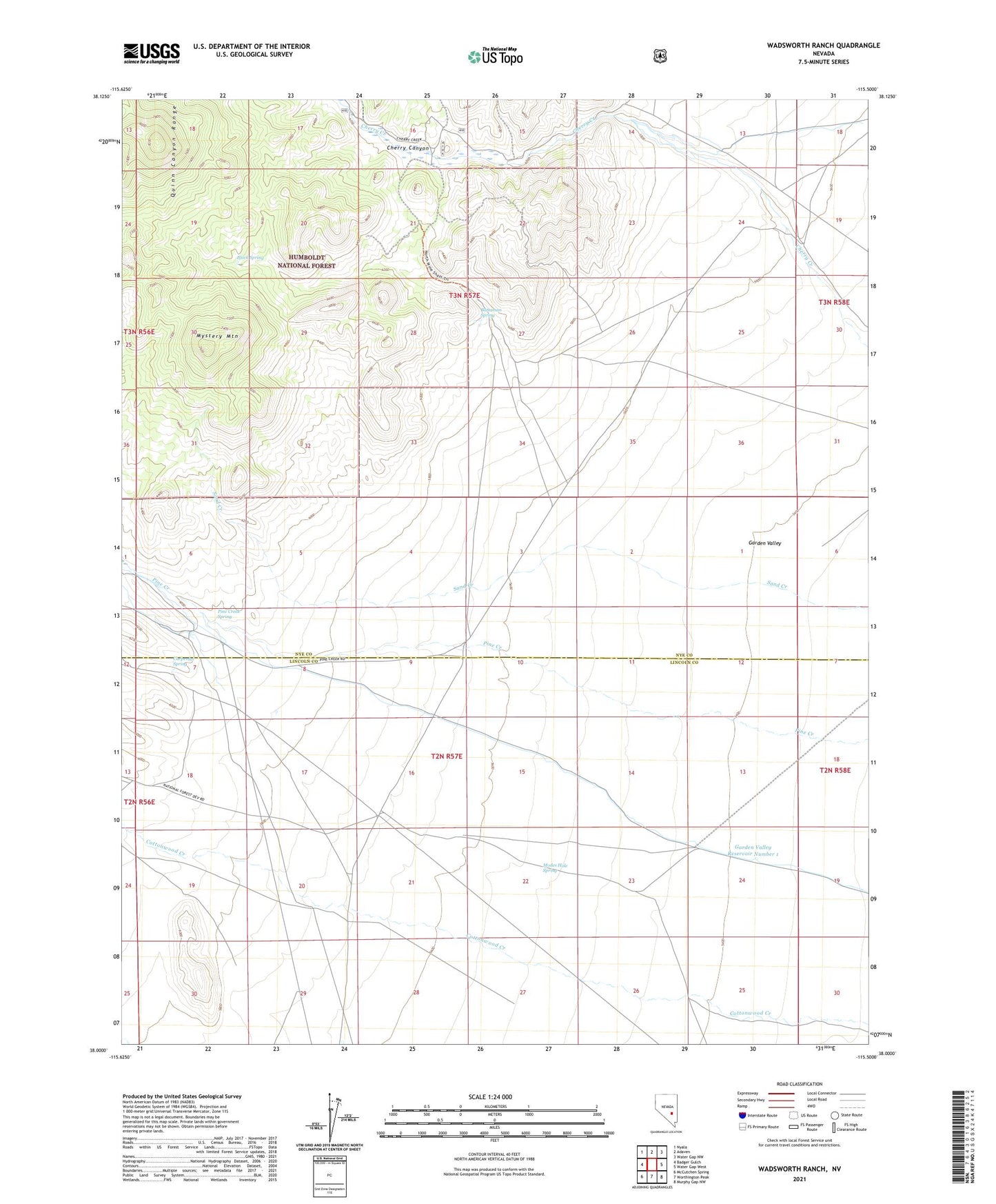
2021 topographic map quadrangle Wadsworth Ranch in the state of Nevada. Scale: 1:24000. Based on the newly updated USGS 7.5' US Topo map series, this map is in the following counties: Nye, Lincoln. The map contains contour data, water features, and other items you are used to seeing on USGS maps, but also has updated roads and other features. This is the next generation of topographic maps. Printed on high-quality waterproof paper with UV fade-resistant inks.
Quads adjacent to this one:
West: Badger Gulch
Northwest: Nyala
North: Adaven
Northeast: Water Gap NW
East: Water Gap West
Southeast: Murphy Gap NW
South: Worthington Peak
Southwest: McCutchen Spring
This map covers the same area as the classic USGS quad with code o38115a5.
Contains the following named places: Battaman Spring, Black Spring, Carpenter Pipe Line, Carpenter Spring, Cherry Canyon, Garden Valley Reservoir Number 1, Iron Cap Mine, Modes Hole Spring, Mystery Mountain, Pine Creek Spring, Uhalde Ranch, Wadsworth Ranch, Walch Ranch