MyTopo
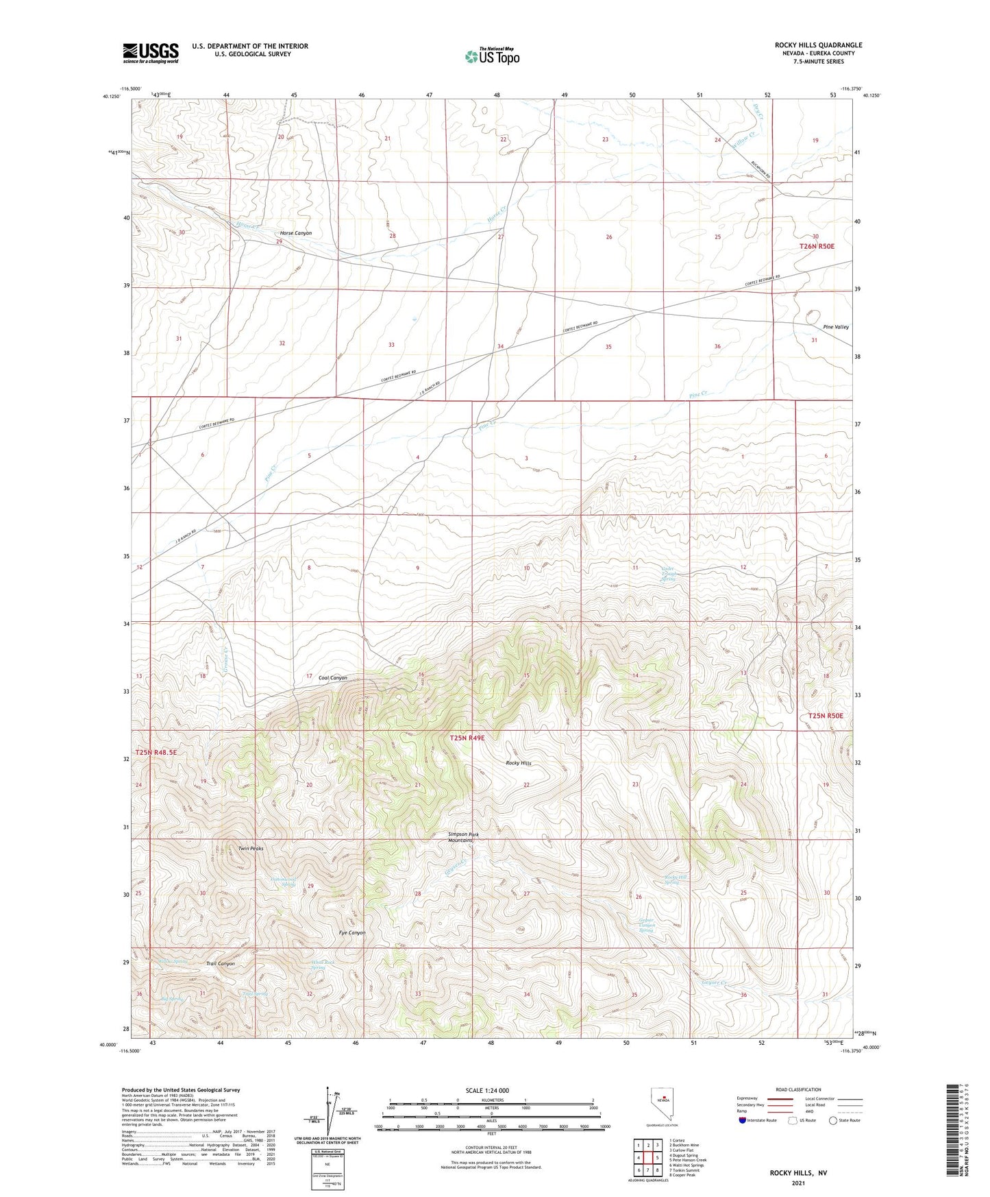
Rocky Hills Nevada US Topo Map
Couldn't load pickup availability
2021 topographic map quadrangle Rocky Hills in the state of Nevada. Scale: 1:24000. Based on the newly updated USGS 7.5' US Topo map series, this map is in the following counties: Eureka. The map contains contour data, water features, and other items you are used to seeing on USGS maps, but also has updated roads and other features. This is the next generation of topographic maps. Printed on high-quality waterproof paper with UV fade-resistant inks.
Quads adjacent to this one:
West: Dugout Spring
Northwest: Cortez
North: Buckhorn Mine
Northeast: Curlow Flat
East: Pete Hanson Creek
Southeast: Cooper Peak
South: Tonkin Summit
Southwest: Walti Hot Springs
This map covers the same area as the classic USGS quad with code o40116a4.
Contains the following named places: Baumann Well, Big Spring, Cadet Trough Spring, Coal Canyon, Cottonwood Spring, Dry Creek, Geyser Canyon Spring, Grouse Creek, Horse Canyon, Rocky Hill Spring, Rocky Hills, Trail Canyon, Trail Spring, Twin Peaks, White Rock Spring, Willow Creek, Willow Spring