MyTopo
Wells Nevada US Topo Map
Couldn't load pickup availability
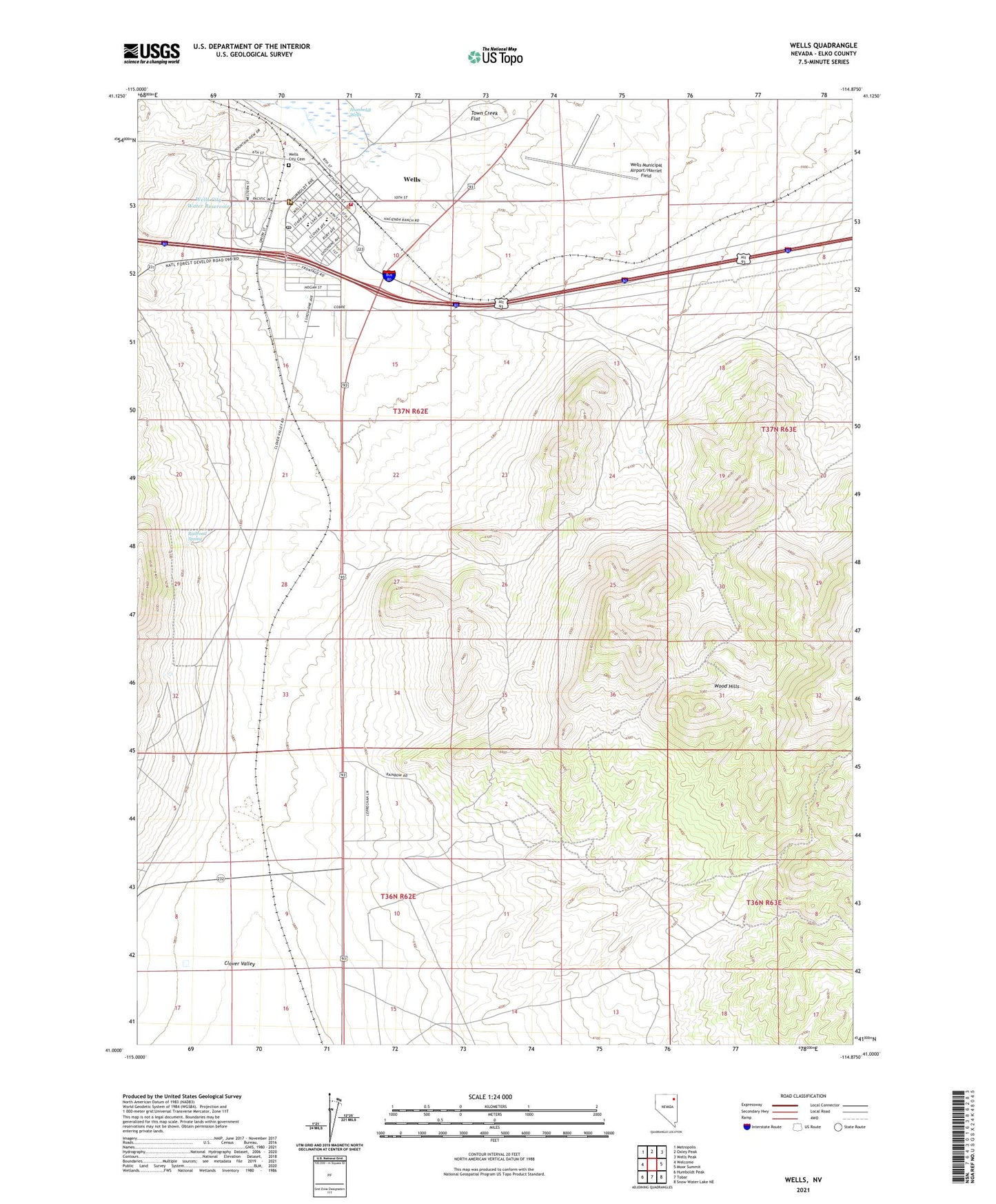
2021 topographic map quadrangle Wells in the state of Nevada. Scale: 1:24000. Based on the newly updated USGS 7.5' US Topo map series, this map is in the following counties: Elko. The map contains contour data, water features, and other items you are used to seeing on USGS maps, but also has updated roads and other features. This is the next generation of topographic maps. Printed on high-quality waterproof paper with UV fade-resistant inks.
Quads adjacent to this one:
West: Welcome
Northwest: Metropolis
North: Oxley Peak
Northeast: Wells Peak
East: Moor Summit
Southeast: Snow Water Lake NE
South: Tobar
Southwest: Humboldt Peak
This map covers the same area as the classic USGS quad with code o41114a8.
Contains the following named places: Boaz, City of Wells, Elko County Ambulance Service - Wells, Elko County Sheriff's Office - Wells Substation, Goble Well, Great Basin College Wells Satellite Center, Humboldt Wells, Kaw, Nevada Highway Patrol Northern Command East - Wells Substation, Railroad Spring, Ruby Valley Elementary School, Wells, Wells City Cemetery, Wells City Golf Course, Wells City Hall, Wells City Park, Wells City Rodeo Arena, Wells City Water Reservoir, Wells Colony, Wells Combined School, Wells District Ranger Office, Wells Elementary School, Wells Municipal Airport/Harriet Field, Wells Post Office, Wells Volunteer Fire Department