MyTopo
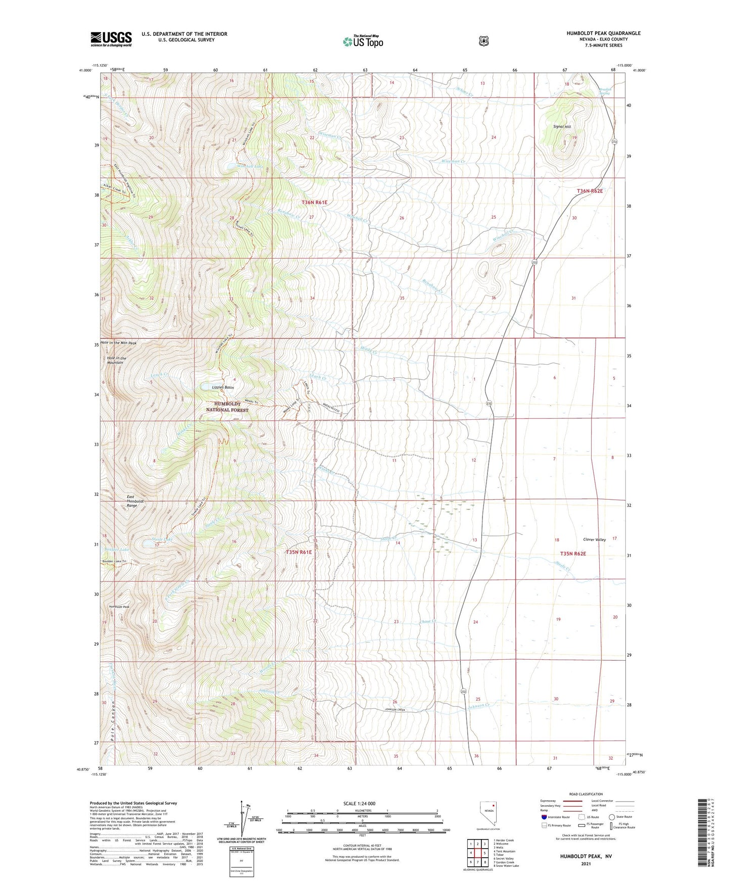
Humboldt Peak Nevada US Topo Map
Couldn't load pickup availability
Also explore the Humboldt Peak Forest Service Topo of this same quad for updated USFS data
2021 topographic map quadrangle Humboldt Peak in the state of Nevada. Scale: 1:24000. Based on the newly updated USGS 7.5' US Topo map series, this map is in the following counties: Elko. The map contains contour data, water features, and other items you are used to seeing on USGS maps, but also has updated roads and other features. This is the next generation of topographic maps. Printed on high-quality waterproof paper with UV fade-resistant inks.
Quads adjacent to this one:
West: Tent Mountain
Northwest: Herder Creek
North: Welcome
Northeast: Wells
East: Tobar
Southeast: Snow Water Lake
South: Gordon Creek
Southwest: Secret Valley
This map covers the same area as the classic USGS quad with code o40115h1.
Contains the following named places: Ballard Ranch, Bradish Spring, Chase Creek, Clover Valley School, East Humboldt Range, East Humboldts Wilderness, Goodwin Ranch, Hole in the Mountain, Hole in the Mountain Peak, Humboldt Peak, Humboldt School, K C Ranch, Leach Creek, Lizzies Basin, Longnecker Ranch, Ralph Fire Lane, Renshaw Creek, Schoer Creek, Schumann Ranch, Shady Creek, Signal Hill, South Fork Steele Creek, Steele Lake, Weeks Creek, Weeks Ranch, Winchell Creek, Winchell Lake, Wiseman Creek, Wood, Wood Post Office, Woods Creek, Wright Ranch