MyTopo
West of Austin Nevada US Topo Map
Couldn't load pickup availability
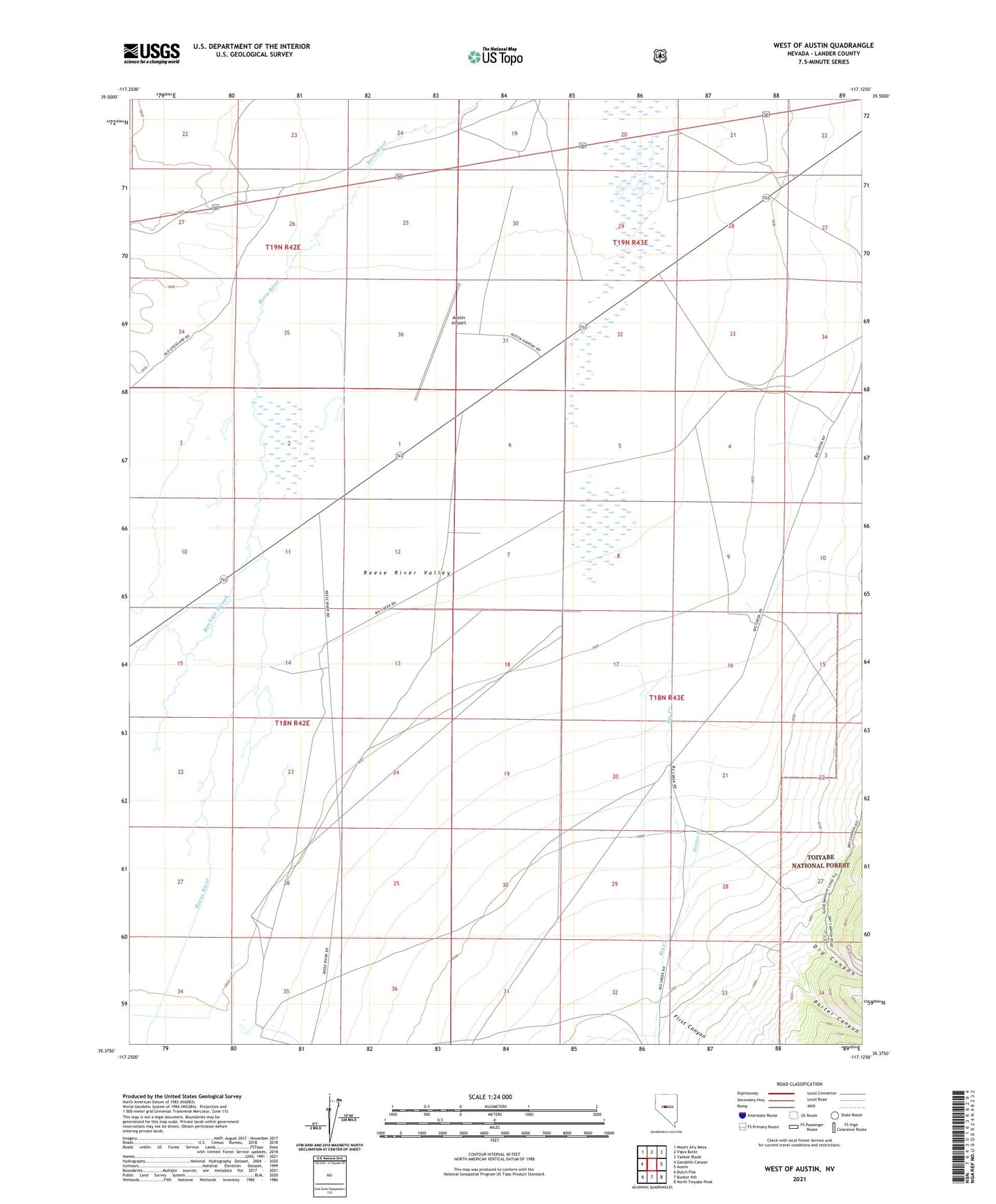
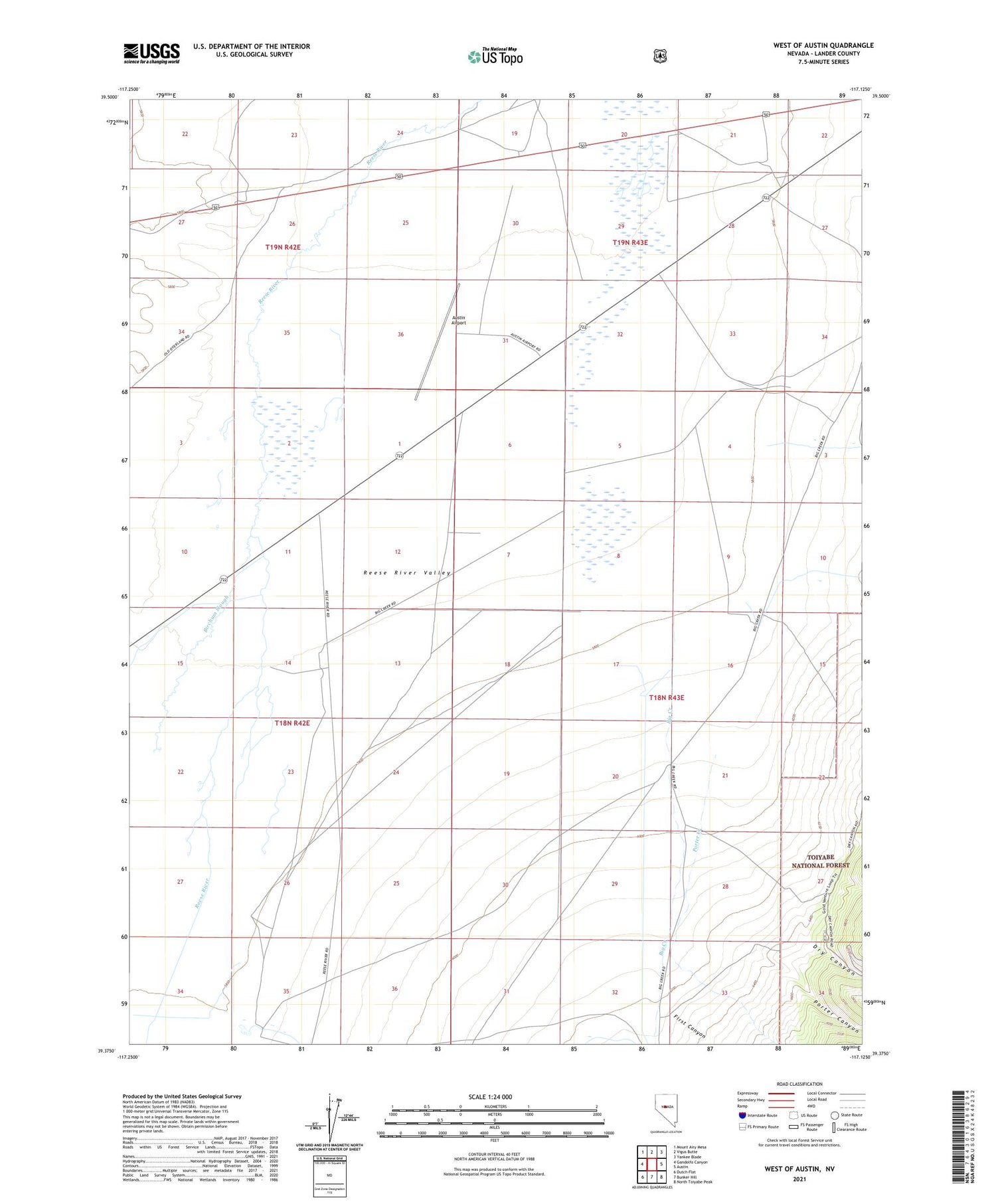
2021 topographic map quadrangle West of Austin in the state of Nevada. Scale: 1:24000. Based on the newly updated USGS 7.5' US Topo map series, this map is in the following counties: Lander. The map contains contour data, water features, and other items you are used to seeing on USGS maps, but also has updated roads and other features. This is the next generation of topographic maps. Printed on high-quality waterproof paper with UV fade-resistant inks.
Quads adjacent to this one:
West: Gandolfo Canyon
Northwest: Mount Airy Mesa
North: Vigus Butte
Northeast: Yankee Blade
East: Austin
Southeast: North Toiyabe Peak
South: Bunker Hill
Southwest: Dutch Flat
Contains the following named places: Austin Airport, Big Creek, Birchum Slough, Canon City, Carter Ranch, Dry Canyon, First Canyon, Gandolfo Ranch, Gondolfo Ranch, Lander City, Parrots Mill, Porter Canyon, Porter Creek, Reese River Valley, Silver Age House, Walsh Home Ranch, White House, ZIP Code: 89310