MyTopo
Gandolfo Canyon Nevada US Topo Map
Couldn't load pickup availability
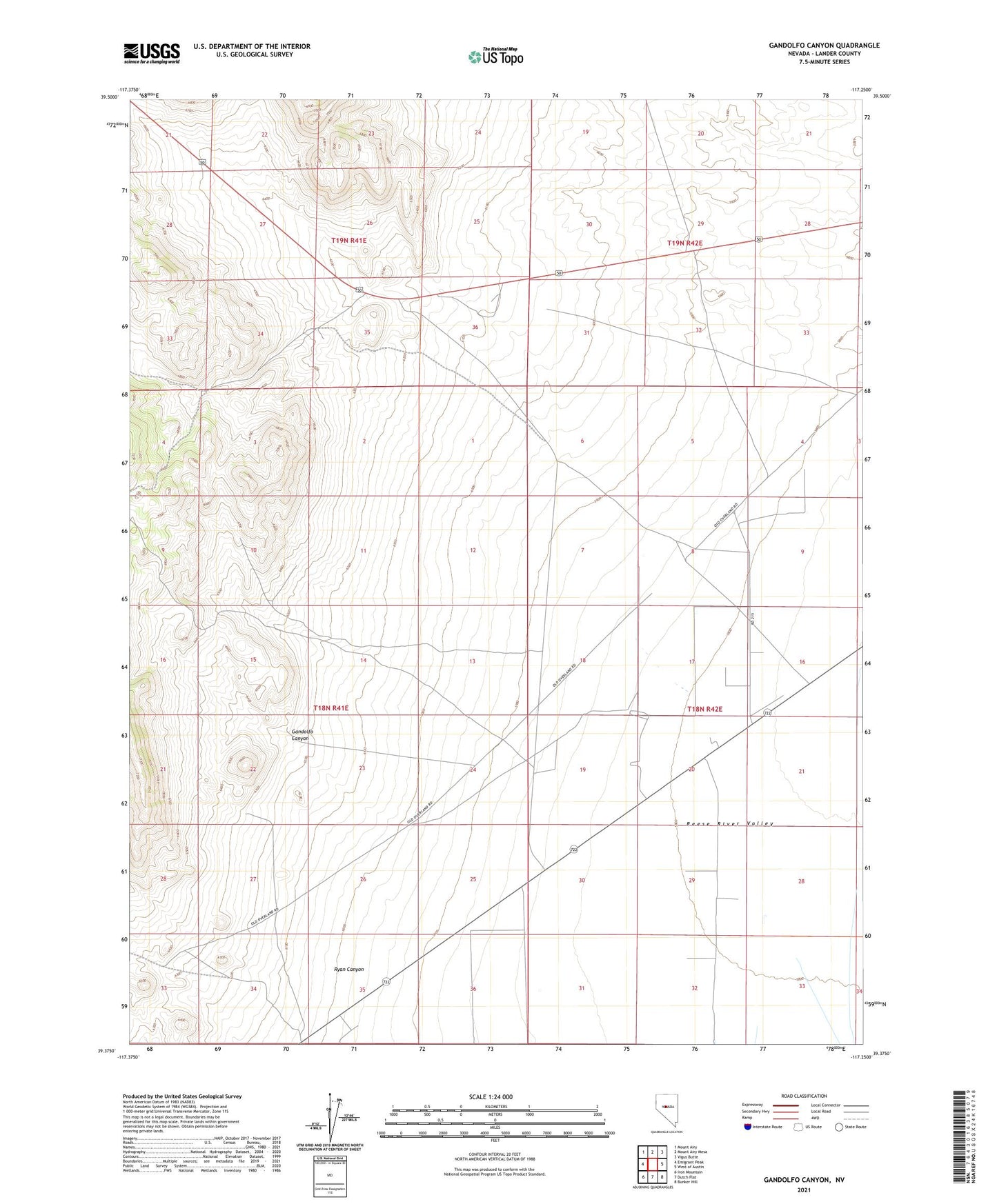
2021 topographic map quadrangle Gandolfo Canyon in the state of Nevada. Scale: 1:24000. Based on the newly updated USGS 7.5' US Topo map series, this map is in the following counties: Lander. The map contains contour data, water features, and other items you are used to seeing on USGS maps, but also has updated roads and other features. This is the next generation of topographic maps. Printed on high-quality waterproof paper with UV fade-resistant inks.
Quads adjacent to this one:
West: Emigrant Peak
Northwest: Mount Airy
North: Mount Airy Mesa
Northeast: Vigus Butte
East: West of Austin
Southeast: Bunker Hill
South: Dutch Flat
Southwest: Iron Mountain
This map covers the same area as the classic USGS quad with code o39117d3.
Contains the following named places: Gandolfo Canyon, Ryan Canyon