MyTopo
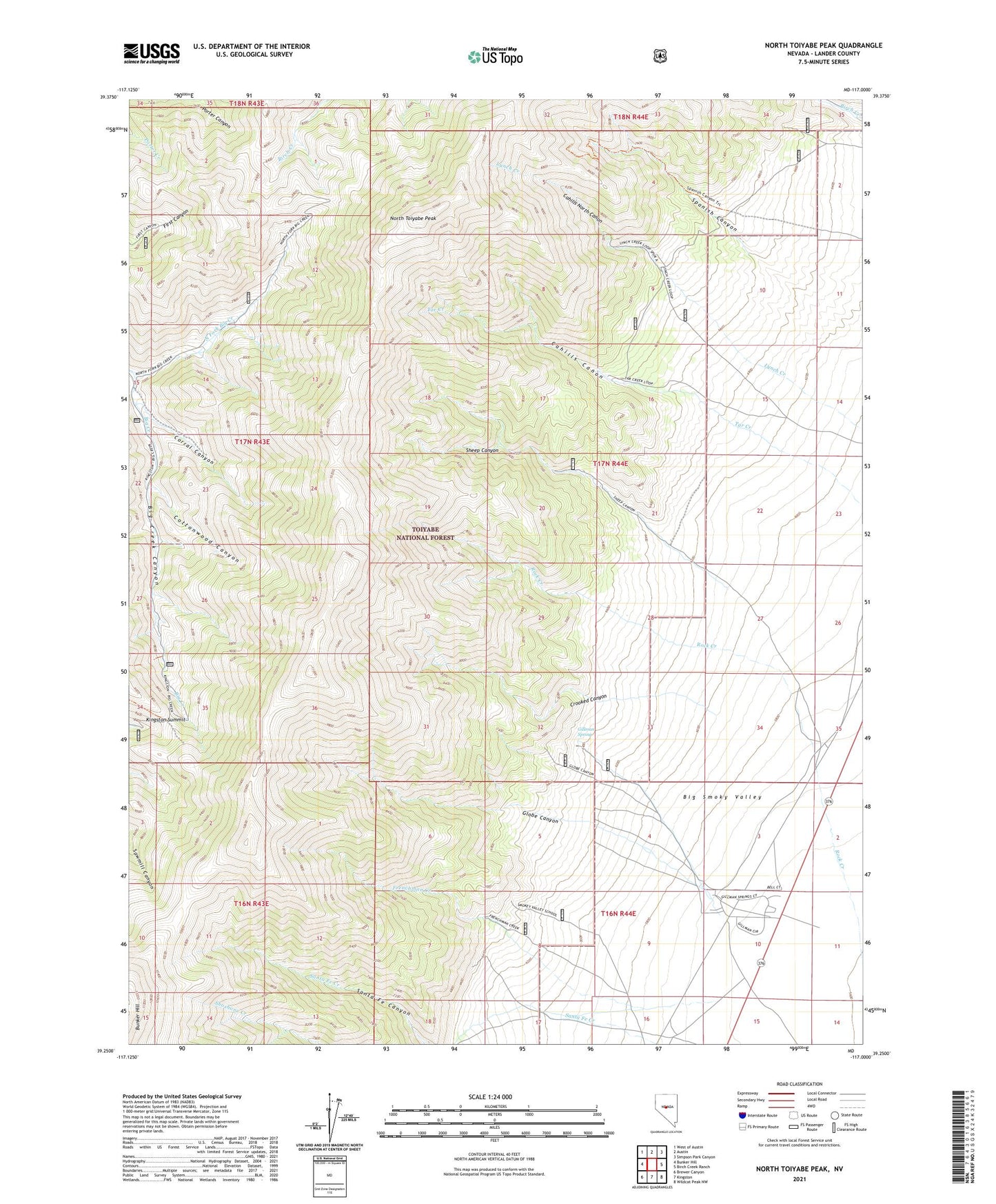
North Toiyabe Peak Nevada US Topo Map
Couldn't load pickup availability
Also explore the North Toiyabe Peak Forest Service Topo of this same quad for updated USFS data
2021 topographic map quadrangle North Toiyabe Peak in the state of Nevada. Scale: 1:24000. Based on the newly updated USGS 7.5' US Topo map series, this map is in the following counties: Lander. The map contains contour data, water features, and other items you are used to seeing on USGS maps, but also has updated roads and other features. This is the next generation of topographic maps. Printed on high-quality waterproof paper with UV fade-resistant inks.
Quads adjacent to this one:
West: Bunker Hill
Northwest: West of Austin
North: Austin
Northeast: Simpson Park Canyon
East: Birch Creek Ranch
Southeast: Wildcat Peak NW
South: Kingston
Southwest: Brewer Canyon
This map covers the same area as the classic USGS quad with code o39117c1.
Contains the following named places: Big Creek Mining District, Birch Creek Mining District, Blue Horizon Mine, Bray Beulah Mine, Bray Mine, Bull Dog Jack Mine, Cahill Mine, Cahills Canon, Cahills North Canon, Corral Canyon, Cottonwood Canyon, Crooked Canyon, Deer Point Mine, Frenchman Creek, Gillman Spring, Globe Canyon, Hard Luck-Pradier Mine, Kingston Summit, Limelight Mine, Lynch Creek Mine, Mineral City, Montrose, North Fork Big Creek, North Toiyabe Peak, Rock Creek, Sheep Canyon, Smoky Valley Mine, Spanish Canyon, T-Bone Mine