MyTopo
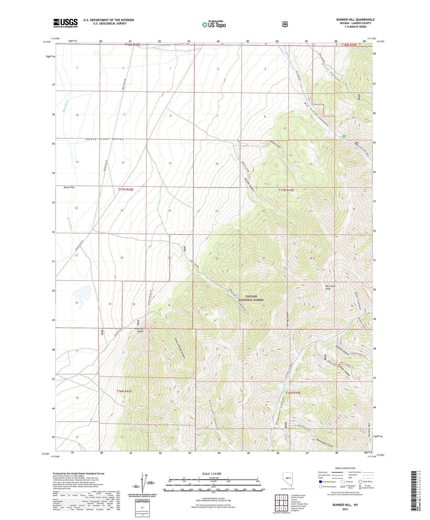
Bunker Hill Nevada US Topo Map
Couldn't load pickup availability
Also explore the Bunker Hill Forest Service Topo of this same quad for updated USFS data
2021 topographic map quadrangle Bunker Hill in the state of Nevada. Scale: 1:24000. Based on the newly updated USGS 7.5' US Topo map series, this map is in the following counties: Lander. The map contains contour data, water features, and other items you are used to seeing on USGS maps, but also has updated roads and other features. This is the next generation of topographic maps. Printed on high-quality waterproof paper with UV fade-resistant inks.
Quads adjacent to this one:
West: Dutch Flat
Northwest: Gandolfo Canyon
North: West of Austin
Northeast: Austin
East: North Toiyabe Peak
Southeast: Kingston
South: Brewer Canyon
Southwest: Reese River Butte
This map covers the same area as the classic USGS quad with code o39117c2.
Contains the following named places: Basin Canyon, Big Creek Campground, Big Creek Canyon, Big Creek Peak, Brooks Canyon, Bunker Hill, Canyon City, Canyon City Post Office, Deer Canyon, Kingston Ranger Station, Mahogany Gulch, Murphy Canyon, Point of Rocks, Point of Rocks Canyon, Reeds Canyon, Sawmill Canyon, Spring Canyon, Watertown