
MyTopo
Willow Grove Nevada US Topo Map
Couldn't load pickup availability
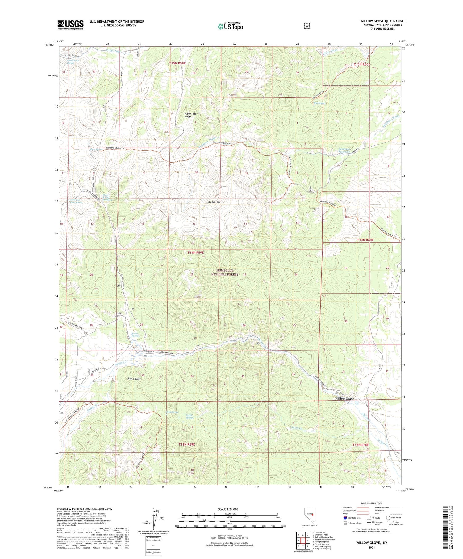
2021 topographic map quadrangle Willow Grove in the state of Nevada. Scale: 1:24000. Based on the newly updated USGS 7.5' US Topo map series, this map is in the following counties: White Pine. The map contains contour data, water features, and other items you are used to seeing on USGS maps, but also has updated roads and other features. This is the next generation of topographic maps. Printed on high-quality waterproof paper with UV fade-resistant inks.
Quads adjacent to this one:
West: Indian Garden Mountain
Northwest: Treasure Hill
North: Limestone Peak
Northeast: Railroad Crossing Dam
East: Blackjack Springs
Southeast: Badger Hole Spring
South: Horse Track Spring
Southwest: Currant Mountain
Contains the following named places: Bald Mountain, Bald Mountain Wilderness, Black Butte, Circle Wash Spring, Copper Creek, Deadman Reservoir, Easter Springs, Ellison Forest Service Facility, Ellison Ranger Station, Ellison Spring Number 2, Indian Creek, Indian Springs, Little Tom Plain Spring, Lund Division, Mud Spring, Mustang Spring Reservoir, Stove Spring, Trail Spring, Willow Grove


