MyTopo
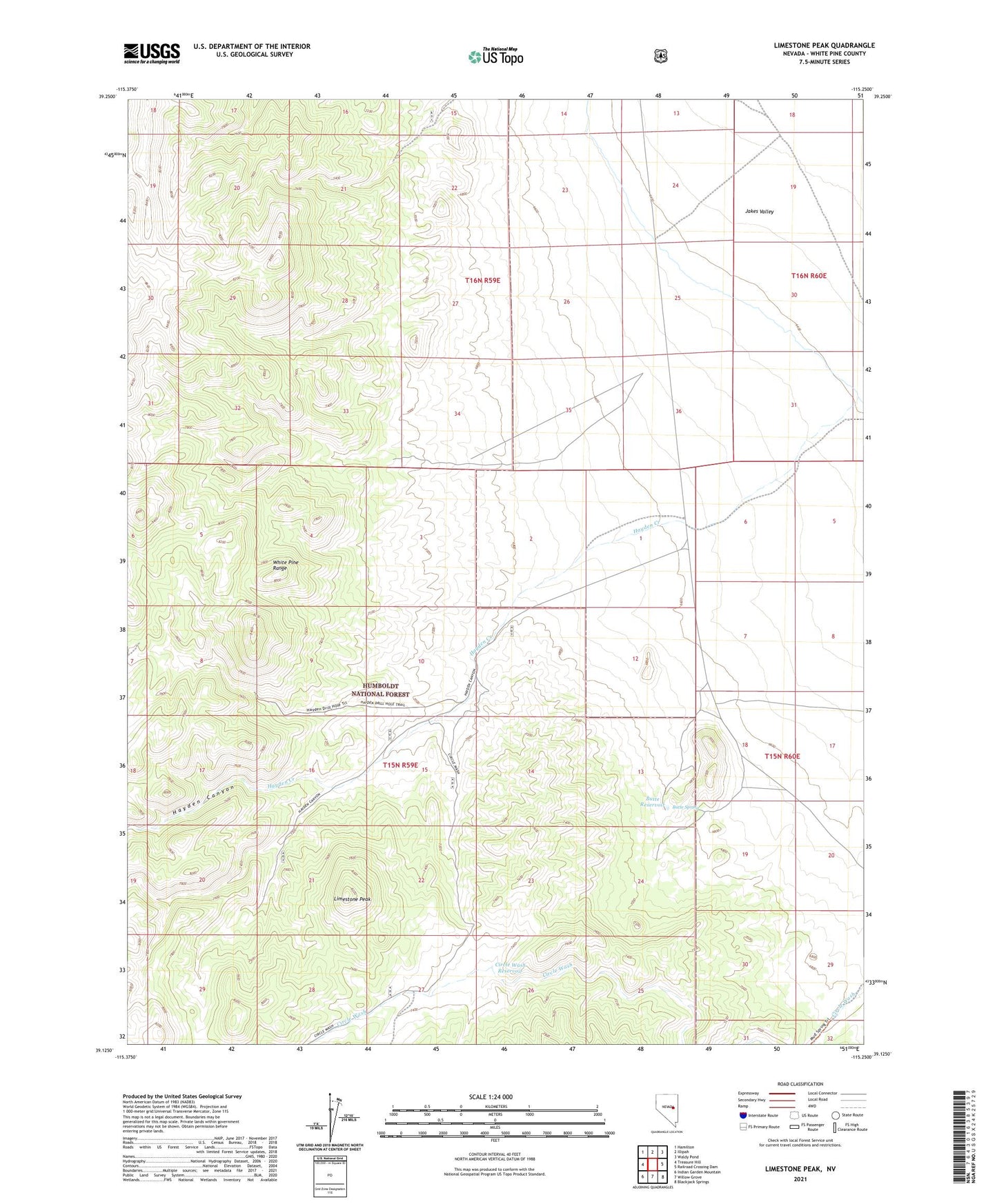
Limestone Peak Nevada US Topo Map
Couldn't load pickup availability
Also explore the Limestone Peak Forest Service Topo of this same quad for updated USFS data
2021 topographic map quadrangle Limestone Peak in the state of Nevada. Scale: 1:24000. Based on the newly updated USGS 7.5' US Topo map series, this map is in the following counties: White Pine. The map contains contour data, water features, and other items you are used to seeing on USGS maps, but also has updated roads and other features. This is the next generation of topographic maps. Printed on high-quality waterproof paper with UV fade-resistant inks.
Quads adjacent to this one:
West: Treasure Hill
Northwest: Hamilton
North: Illipah
Northeast: Waldy Pond
East: Railroad Crossing Dam
Southeast: Blackjack Springs
South: Willow Grove
Southwest: Indian Garden Mountain
This map covers the same area as the classic USGS quad with code o39115b3.
Contains the following named places: Butte Reservoir, Butte Spring, Circle Wash Reservoir, Hayden Canyon, Limestone Peak, Shellback Wilderness