MyTopo
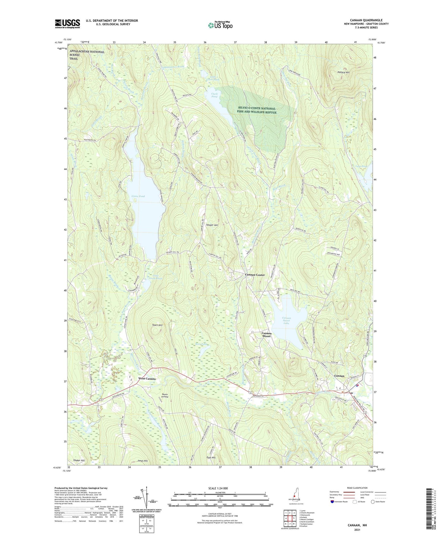
Canaan New Hampshire US Topo Map
Couldn't load pickup availability
Also explore the Canaan Forest Service Topo of this same quad for updated USFS data
2024 topographic map quadrangle Canaan in the state of New Hampshire. Scale: 1:24000. Based on the newly updated USGS 7.5' US Topo map series, this map is in the following counties: Grafton. The map contains contour data, water features, and other items you are used to seeing on USGS maps, but also has updated roads and other features. This is the next generation of topographic maps. Printed on high-quality waterproof paper with UV fade-resistant inks.
Quads adjacent to this one:
West: Enfield
Northwest: Lyme
North: Smarts Mountain
Northeast: Wentworth
East: Mount Cardigan
Southeast: Grafton
South: Enfield Center
Southwest: North Grantham
This map covers the same area as the classic USGS quad with code o43072f1.
Contains the following named places: Bear Pond, Call Brook, Canaan, Canaan Census Designated Place, Canaan Center, Canaan Christian School, Canaan Elementary School, Canaan Fire Department, Canaan First Aid Stabilization Team Squad, Canaan Police Dept, Canaan Post Office, Canaan Street, Canaan Street Historic District, Canaan Street Lake, Canaan Town Library and Historical Museum, Canaan Union Academy, Cardigan Mountain School, Clark Pond, Clark Pond Brook, Crystal Lake Brook, Eastman Lake Dam, Eastman Pond, Goose Pond, Goose Pond Brook, Goose Pond Dam, Gulf Brook, Haines Brook, Halley School, Hinkson Brook, Hoyt Brook, Indian River, Indian River School, Lary Pond, Little Clark Pond, Little Goose Pond, Lovejoy Brook, Marshall Brook, Mascoma Valley Regional High School, Moore Airfield, Moose Brook, North Canaan School, Orange Brook, Pattee Station, Pollard Hill, Pressey Brook, Sawyer Hill, Straw Brook, Tinkhamtown Brook, Town Hill, Town of Canaan, Tunis Brook, Tunis School, West Canaan, West Farms School, Williams Field, ZIP Code: 03741